
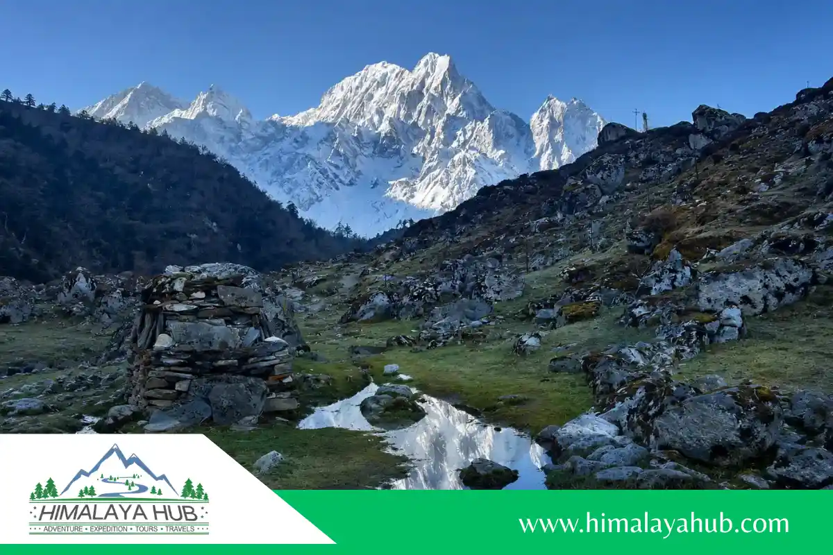

The Manaslu Circuit Trek is one of Nepal’s most rewarding long-distance hikes. It circles Mount Manaslu, standing at 8,163 m, the eighth-highest mountain in the world. The route takes trekkers through the Gorkha region of Gandaki Province, following the Budhi Gandaki River before crossing Larkya La Pass at about 5,106 m (16,752 ft). It is often called the “last great Himalayan adventure” because it still feels remote, wild, and far less commercial than many famous trekking trails.
A typical Manaslu Trek takes around 13 to 16 days, depending on your chosen route, rest days, transport, and side hikes. The full journey is roughly 177 km (110 miles), although the trekking distance can vary between itineraries. You start in warm, low river valleys, walk through forests and waterfalls, visit Tibetan Buddhist villages such as Lho, Sama Gaun, and Samdo, and eventually reach a cold high-mountain landscape near the pass. This change from subtropical hills to alpine terrain gives the Manaslu Circuit Nepal its remarkable variety.
Compared with the Annapurna Circuit, the Manaslu Circuit offers a quieter trail, fewer road sections, and a stronger sense of wilderness. Teahouses are available along the route, so it is not a camping expedition, but facilities become simpler at higher elevations. This is also a restricted-area trek: visitors need a Manaslu Restricted Area Permit, conservation permits, and a licensed guide arranged through a registered Nepali trekking agency.
This Manaslu Circuit Trekking Guide explains the key information you need before going: the route, ideal trekking season, permits, costs, fitness preparation, altitude acclimatization, food, packing, and safety. The trek is moderate to strenuous, especially on the long crossing of Larkya La Pass, but it does not require technical climbing skills. With enough training, a sensible itinerary, and time to acclimatize, it is an achievable and unforgettable Himalayan adventure.
Manaslu Circuit Expedition at a Glance
| Feature | Detail |
| Region | Gorkha & Manang districts, Gandaki Province, Nepal |
| Duration | 13–16 days |
| Total distance | About 177 km (110 miles), depending on the route and side trips |
| Highest Point | Larkya La Pass, 5,106m (16,752 ft) |
| Difficulty | Moderate to strenuous (high pass, remote, no technical climbing) |
| Main mountain | Mount Manaslu, 8,163 m, the world’s eighth-highest peak |
| Best Seasons | March–May (spring), September–November (autumn) |
| Permits Required | Manaslu RAP, MCAP, ACAP, Chum Nubri local permit |
| Guide Policy | Mandatory (licensed guide + minimum 2 trekkers or 1 trekker via agency) |
| Accommodation | Teahouses (basic to mid-range; attached bathrooms except at Deng/Dharamsala) |
| Typical Cost (2026) | $940–$1,290 per person (budget) |
| Fitness Level | Good to very good (5–7 hours walking/day, altitude acclimatization) |
What Is the Manaslu Circuit Trek?
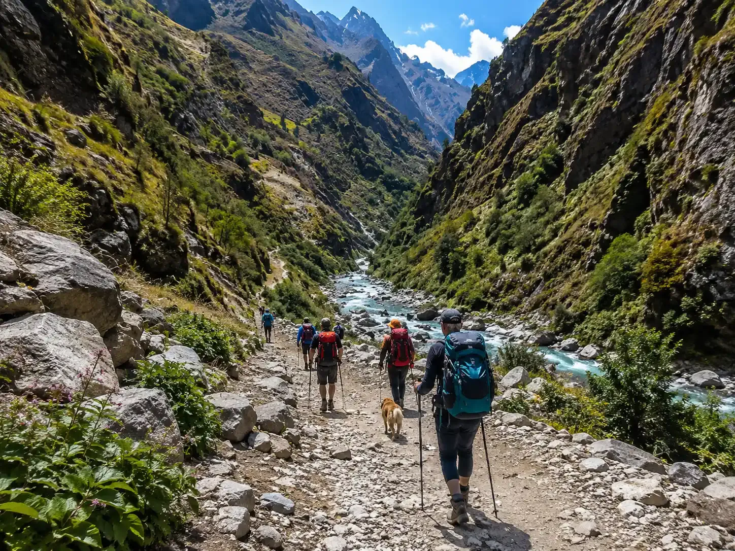
The Manaslu Circuit Trek is a remote Himalayan journey that circles Mount Manaslu, the world’s eighth-highest mountain at 8,163 m. The trail begins in Nepal’s lower hills and follows the Budhi Gandaki River through deep valleys, forests, waterfalls, and small mountain villages. As you walk higher, the landscape changes from green hills to rocky alpine terrain, with strong Tibetan Buddhist influence in villages such as Lho, Sama Gaun, and Samdo.
The Manaslu Circuit Trek distance is usually about 110–120 km of walking, although the total trip distance (177km) becomes longer when transport and side hikes are included. The route gradually climbs to Larkya La Pass at 5,106 m, then descends through Bimthang into the Marsyangdi Valley. It is less commercial than many major Nepal treks, so expect simpler teahouses, quieter trails, and a stronger wilderness feeling.
Why Trek the Manaslu Circuit?
The main reason to choose the Manaslu Trek is its quiet and authentic feel. While Everest Base Camp and Annapurna can receive large crowds in peak season, Manaslu often feels calmer. You can spend hours walking through valleys and forests with only a few other trekkers around. Villages like Sama Gaun, Samdo, and Lho still reflect Tibetan Buddhist traditions through prayer flags, mani walls, chortens, and daily mountain life.
The trek also passes through the Manaslu Conservation Area, home to 33 mammal species, including snow leopards, Himalayan tahr, musk deer, and red pandas. More than 110 bird species have been recorded in the area. You may not see the rare animals, snow leopards are famously shy, but the wild setting is part of the experience.
One of the best parts of the Manaslu Circuit Nepal is how quickly the scenery changes. You walk through the narrow Budhi Gandaki gorge, cross suspension bridges, pass rhododendron forests, and reach high valleys near Birendra Lake and Samagaun. Above the tree line, the views open toward Himlung Himal, Cheo Himal, Kang Guru, and other dramatic peaks around Larkya La Pass.
The cultural side is equally memorable. The route follows old Himalayan trade paths and passes important places such as Pungyen Gompa and Serang Gumba. Since Manaslu is a restricted-area trek, tourism is more controlled than on open routes. This helps preserve local traditions, but it also means you must trek with the correct permits, a licensed guide, and an organized plan.
Manaslu vs. Annapurna vs. EBC
| Feature | Manaslu Circuit Trail | Annapurna Circuit | Everest Base Camp |
| Difficulty | Moderate to strenuous; remote terrain and a demanding pass day | Moderate to strenuous; long route with a higher pass | Moderate to strenuous; high altitude and repeated uphill/downhill days |
| Maximum altitude | Larkya La Pass, 5,106 m | Thorong La Pass, 5,416 m | Everest Base Camp, 5,364 m; Kala Patthar can reach about 5,545 m |
| Typical cost range | About $1,100–$3,500+ per person | About $900–$2,500+ per person | About $1,400–$3,500+ per person |
| Teahouse density | Moderate; basic and less frequent at higher elevations | High; many villages and lodging choices | High; extensive lodge network on the main trail |
| Road sections | Limited on the core trekking route, with rough road transfers at each end | More road exposure in several sections | No road on the main trail; flights or helicopter/road access are used to reach the trailhead |
| Permit complexity | High; restricted-area permit plus conservation permits and guide requirements | Low to moderate; conservation-area requirements | Moderate; park permit and local entry fees |
Manaslu is ideal if you want a quieter trail, a longer wilderness experience, and deep cultural exposure. Annapurna is easier to arrange and offers more services, while Everest Base Camp is best for trekkers whose main goal is seeing Everest and the Khumbu region.
How Long Is the Manaslu Circuit Trek?
The Manaslu Circuit Trek is commonly completed in 13 or 16 days. A 13-day itinerary is faster and best for fit trekkers with limited time, while a 16-day itinerary adds valuable acclimatization and flexibility for weather. Both routes cross Larkya La Pass and finish through the Annapurna side.
13 days Manaslu Circuit Trek Itinerary
Day 1 • Drive from Kathmandu to Machha Khola (870m) | 160km | ~10 Hours
Your adventure begins today with an early morning departure from Kathmandu. You will travel by private jeep or local bus along the Prithvi Highway, following the beautiful Trishuli and Budhi Gandaki rivers. The drive takes you through green terraced hills, small roadside towns, and rural Nepali villages, a great introduction to the country’s stunning landscapes.
After a long but scenic 10-hour drive, you arrive at Machha Khola, a small riverside village sitting at 870 meters. Tonight you settle into your teahouse, enjoy a warm meal, and get a good night’s rest before your first real trekking day tomorrow.
- Distance: 160 km
- Drive: ~10 Hours
- Altitude: 870m
- Accommodation: Teahouse
- Meals: Breakfast, Lunch & Dinner
Day 2 • Trek from Machha Khola to Jagat (1,340m) | 16km | ~6 Hours
Today is your first full day of walking on the Manaslu Circuit trail, and it’s a beautiful one! The path follows alongside the Budhi Gandaki River, crossing several traditional suspension bridges as you make your way upstream. You walk through lush subtropical forests, past terraced farmlands, and through small ethnic villages where life has remained simple and peaceful for centuries.
The trail is relatively manageable today, a perfect warm-up for the bigger days ahead. You finish the day in Jagat, which is the first official checkpoint village on the Manaslu Circuit. Your permits will be checked here by the authorities.
- Distance: 16 km
- Walk: ~6 Hours
- Altitude: 1,340m
- Accommodation: Teahouse
- Meals: Breakfast, Lunch & Dinner
Day 3 • Trek from Jagat to Deng (1,860m) | 20km | ~6 Hours
Leaving Jagat behind, the trail today takes you deeper into the Budhi Gandaki River valley. The path winds through rocky gorges, dense bamboo forests, and narrow canyon sections that hug the riverbanks tightly. You will cross the river several more times on swinging suspension bridges, great fun and great photo opportunities!
As you walk further, you will begin to notice a gradual shift in culture. The villages here start showing more and more Tibetan Buddhist influence, you’ll spot mani walls (carved stone prayer walls), colorful prayer flags strung between houses, and the sound of spinning prayer wheels. By the time you reach Deng, you’ll feel like you’ve stepped into an entirely different world.
- Distance: 20 km
- Walk: ~6 Hours
- Altitude: 1,860m
- Accommodation: Teahouse
- Meals: Breakfast, Lunch & Dinner
Day 4 • Trek from Deng to Namrung (2,630m) | 20km | ~6 Hours
Today is another rewarding full day on the trail. The path climbs steadily through a mix of rhododendron and oak forests, with the roaring Budhi Gandaki River as your constant companion below. The landscape grows more dramatic with every step, steep valley walls, cascading waterfalls, and the first hints of snowcapped peaks appearing through the clouds above.
You pass through several remote villages along the way, each one more traditional and charming than the last. As you arrive in Namrung, you are rewarded with your first truly impressive mountain views. On a clear evening, you can see the magnificent Ganesh Himal and Sringi Himal glowing in the golden light of sunset.
- Distance: 20 km
- Walk: ~6 Hours
- Altitude: 2,630m
- Accommodation: Teahouse
- Meals: Breakfast, Lunch & Dinner
Day 5 • Trek from Namrung to Lho (3,180m) | 11km | ~5 Hours
Today is a shorter but very scenic day as you make your way to the beautiful village of Lho. The trail climbs gently through high-altitude terrain, and the mountain views just keep getting better. This is the day when Mount Manaslu (8,163m), the 8th highest mountain in the world, truly reveals itself in all its glory. Seeing Manaslu up close for the first time is a moment you will never forget.
Lho is a traditional Tibetan-style village with stone houses, winding alleyways, and a beautiful old monastery overlooking the valley. We highly recommend taking a short walk up to the Lho Monastery in the afternoon, the views of Manaslu from there are absolutely spectacular and the monks are very welcoming.
- Distance: 11 km
- Walk: ~5 Hours
- Altitude: 3,180m
- Accommodation: Teahouse
- Meals: Breakfast, Lunch & Dinner
Day 6 • Trek from Lho to Samagaun (3,530m) via Pungen Gompa (4,000m) | 15km | ~6 Hours
Today’s route is one of the most memorable days of the entire Manaslu Circuit Trek. You begin by climbing up to the stunning Pungen Gompa (4,000m), an ancient monastery dramatically perched high above the valley with jaw-dropping, unobstructed views of Mount Manaslu and the surrounding glaciers. This is arguably the best viewpoint of Manaslu on the entire circuit and a truly magical place to spend some time.
After soaking in the views and exploring the monastery, you descend and continue along the trail toward Samagaun. This large and welcoming village sits in a wide open valley completely surrounded by towering Himalayan peaks. Samagaun has a strong Tibetan cultural identity, you can see traditional stone houses, local people in traditional dress, yaks grazing nearby, and beautiful monasteries dotting the hillsides.
- Distance: 15 km
- Walk: ~6 Hours
- Side Trip Altitude: Pungen Gompa at 4,000 m
- Altitude: 3,530m
- Accommodation: Teahouse
- Meals: Breakfast, Lunch & Dinner
Day 7 • Rest Day in Samagaun (3,530m)
Today is your important acclimatization day in Samagaun, and this rest day is not just recommended, it is essential for your safety. Spending a full extra day at this altitude allows your body to slowly and naturally adjust before you climb higher. Skipping this day would put you at serious risk of altitude sickness at the Larkya Pass.
But don’t worry, “rest day” doesn’t mean you have to stay in bed! There are plenty of wonderful things to do in and around Samagaun:
- Take a hike up to Manaslu Base Camp for incredible close-up views of the mountain’s massive south face.
- Visit the beautiful Birendra Lake (3,900m), a glacial lake with stunning reflections of Manaslu.
- Explore the Ripchet Monastery and interact with the local monks.
- Walk through the village, interact with local people, and learn about Tibetan culture.
- Sit back, relax at the teahouse, sip on warm butter tea, and enjoy the mountain scenery.
Acclimatization Day
- Rest Day: Important
- Altitude: 3,530m
- Accommodation: Teahouse
- Meals: Breakfast, Lunch & Dinner
Day 8 • Trek from Samagaun to Samdo (3,875m) | 9km | ~4 Hours
Today is a short and relatively easy walking day, but that is completely intentional. This shorter day gives your body one more opportunity to continue acclimatizing as you gradually gain altitude. The trail from Samagaun to Samdo crosses open, high-altitude terrain with wide valley views and a landscape that feels increasingly remote and wild.
Samdo is a tiny but fascinating village located very close to the Tibetan border. On a clear day, you can actually see across into Tibet from the village, a remarkable feeling. The village has a small but lively local market where Tibetan and Nepali traders exchange goods. It’s a great place to explore in the afternoon.
- Distance: 9 km
- Walk: ~4 Hours
- Altitude: 3,875m
- Accommodation: Teahouse
- Meals: Breakfast, Lunch & Dinner
Day 9 • Trek from Samdo to Dharamsala / Larkya La Phedi (4,460m) | 7km | ~3 Hours
Today’s walk is short in distance but big in importance. You make your way from Samdo up to Dharamsala (also known as Larkya La Phedi, meaning “foot of Larkya Pass”), which serves as the base camp for tomorrow’s big pass crossing. The trail climbs steadily through a wide glacial valley, and the terrain becomes increasingly rocky and barren as you gain altitude.
The teahouse facilities at Dharamsala are very basic, this is one of the most remote points on the entire trek. Arrive early, eat a filling meal, stay well hydrated, and go to bed as early as possible. You will be waking up in the middle of the night tomorrow for the biggest challenge of the entire Manaslu Circuit Trek.
Tip: Lay out all your cold-weather gear tonight. Pack your bag the night before so you don’t have to do it in the dark at 2 AM!
- Distance: 7 km
- Walk: ~3 Hours
- Altitude: 4,460m
- Accommodation: Teahouse
- Meals: Breakfast, Lunch & Dinner
Day 10 • Trek from Dharamsala to Bimthang (3,720m) via Larkya La Pass (5,106m) | 24km | ~10 Hours
⭐ This is the most thrilling and challenging day of the entire Manaslu Circuit Trek!
Your alarm goes off at 2:00 AM. You pull on your warmest layers, strap on your headlamp, and step out into the cold, dark mountain night. The climb to Larkya La Pass (5,106m) begins immediately and is steep, snowy, and physically demanding, but absolutely worth every single step.
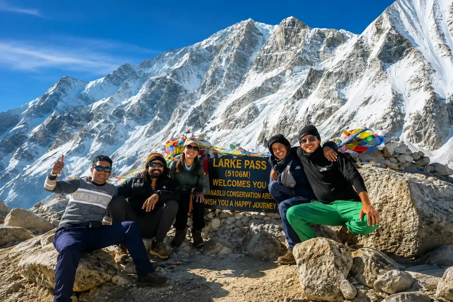
As you near the top of the pass, the first light of sunrise begins to paint the Himalayan peaks in shades of orange and gold. And then, as you step onto the summit of Larkya La, the world opens up in front of you. The panoramic views from the top are nothing short of breathtaking, you can see Manaslu, Himlung Himal, Cheo Himal, Gyagi Kung, Kang Guru, Annapurna II, and countless other Himalayan giants stretching endlessly in every direction.
Take your photos, celebrate with your team, and then begin the long descent down the other side. The path down to Bimthang is steep and can be icy in sections, so careful footing is essential. As you lose altitude, the air gets warmer, the vegetation returns, and the beautiful valley of Bimthang welcomes you like a reward at the end of a hard day’s work.
⚠️ Note: This day involves an early 2 AM start, 10 hours of walking, freezing temperatures, and high altitude. Your guide will be with you every single step of the way. Follow their instructions closely and walk at a slow, steady pace.
- Distance: 24 km
- Walk: ~10 Hours
- Highest Point: Larkya La Pass, 5,106 m
- Altitude: 3,720m
- Accommodation: Teahouse
- Meals: Breakfast, Lunch & Dinner
Day 11 • Trek from Bimthang to Gho (2,550m) | 14km | ~4 Hours
After yesterday’s epic Larkya Pass crossing, today is a well-deserved easier descent day. The trail drops steadily from Bimthang through gorgeous high-altitude meadows, crossing rocky streams and passing through patches of pine and rhododendron forest. The air is noticeably warmer and thicker at this altitude, and your legs, while tired, will feel the joy of the descent.
You pass by the beautiful Ponkar Lake and enjoy wide open views of the Manaslu massif from behind as you walk away from it for the first time on the trek. By the time you reach the small and peaceful village of Gho, your body is ready for a good meal and a long, deep sleep.
- Distance: 14 km
- Walk: ~4 Hours
- Altitude: 2,550m
- Accommodation: Teahouse
- Meals: Breakfast, Lunch & Dinner
Day 12 • Trek from Gho to Dharapani (1,860m) | 10km | ~3 Hours
Today is your final day of trekking on the Manaslu Circuit, and it ends on a wonderful note. The trail descends gently through terraced fields, small villages, and lush lower-valley forests as you make your way down to Dharapani. The air is warm, the sounds of birds fill the trees, and the weight of the high Himalayas slowly gives way to a more relaxed, comfortable feeling.
At Dharapani, the Manaslu Circuit trail officially connects with the Annapurna Circuit trail. This is a significant junction, a place where two of Nepal’s greatest trekking routes meet. Take a moment to look back at the mountains behind you and let it all sink in. You have just completed the Manaslu Circuit Trek!
Tonight, celebrate with your guide over a warm dinner and a well-earned rest.
- Distance: 10 km
- Walk: ~3 Hours
- Altitude: 1,860m
- Accommodation: Teahouse
- Meals: Breakfast, Lunch & Dinner
Day 13 • Drive from Dharapani to Kathmandu (1,324m) | 240km | ~10 Hours
On your final day, you board a private jeep or local bus from Dharapani for the long but scenic drive back to Kathmandu. The road winds through beautiful mountain valleys, terraced hillsides, and the busy highway towns of the Gandaki Province. It’s a long journey, but you’ll have plenty of great memories to replay in your mind as you watch the mountains slowly disappear behind you.
When you arrive back in Kathmandu, our team will be there to welcome you. In the evening, we invite you to a farewell dinner to celebrate your incredible achievement. You have trekked through one of Nepal’s most remote and beautiful regions, crossed a 5,106-meter mountain pass, and experienced a side of the Himalayas that very few people in the world ever get to see.
Congratulations, you did it!
- Distance: 240 km
- Drive: ~10 Hours
- Altitude: 1,324m
- Accommodation: Guesthouse
- Meals: Breakfast, Farewell Dinner
Chat with us — real trekking experts, not bots.
16 days Manaslu Circuit Trek Itinerary
Day 01: Arrival in Kathmandu (1,324m)
Welcome to Nepal! Your Manaslu Circuit Trek adventure officially begins today. Our friendly representative will greet you at Tribhuvan International Airport (TIA) and transfer you to your hotel in Kathmandu. After checking in, take some time to rest and recover from your journey.
In the evening, your trek leader will meet you for a detailed briefing session, covering your itinerary, permits, gear check, and what to expect on the trail. If you are feeling fresh, take a short walk around the lively streets of Thamel and enjoy your first taste of Nepali food and culture.
- Altitude: 1,324m
- Activity: Airport Pickup & Trek Briefing
- Accommodation: Hotel in Kathmandu
- Meals: Welcome Dinner
Day 02: Sightseeing in Kathmandu Valley – UNESCO World Heritage Sites
Before heading into the mountains, spend a full day exploring the incredible cultural treasures of Kathmandu Valley. Your guide will take you on a sightseeing tour of some of the most iconic UNESCO World Heritage Sites in Asia.
Visit the sacred Pashupatinath Temple on the banks of the Bagmati River, marvel at the enormous Boudhanath Stupa, one of the largest Buddhist stupas in the world, and walk through the historic Kathmandu Durbar Square with its ancient palaces and temples. This is also the perfect day to pick up any last-minute trekking gear from the shops in Thamel.
- Altitude: 1,324m
- Activity: Cultural Sightseeing Tour
- Accommodation: Hotel in Kathmandu
- Meals: Breakfast
Day 03: Drive Kathmandu to Soti Khola (700m) | 145km | 8 Hours
Your mountain journey begins early this morning with a long but scenic drive from Kathmandu to Soti Khola. You travel by private jeep through the winding hills and river valleys of central Nepal. The road passes through busy market towns and quiet farming villages, giving you a great first glimpse of rural Nepali life.
As you get closer to Soti Khola, the landscape becomes wilder and more dramatic. The road gets rough towards the end, but the views make it worthwhile. By the time you arrive, the sound of the Budhi Gandaki River rushing nearby will tell you that your trekking adventure is just one sleep away.
- Distance: 145km
- Drive: ~8 Hours
- Altitude: 700m
- Accommodation: Teahouse
- Meals: Breakfast, Lunch & Dinner
Day 04: Trek Soti Khola to Machha Khola (870m) | 14km | 5 Hours
Today your boots hit the trail for the very first time! The path begins by winding through sub-tropical jungle, bamboo groves, and small riverside settlements. You will cross several suspension bridges swinging over the roaring Budhi Gandaki River, a dramatic and exciting introduction to Himalayan trekking.
The trail is relatively gentle today, making it a perfect warm-up for your legs and lungs. You pass through the small villages of Khursane and Lapubesi before arriving at Machha Khola, whose name literally means “Fish River” in Nepali. Settle in, rest your legs, and fuel up with a hearty teahouse dinner.
- Distance: 14km
- Walk: ~5 Hours
- Altitude: 870m
- Accommodation: Teahouse
- Meals: Breakfast, Lunch & Dinner
Day 05: Trek Machha Khola to Jagat (1,340m) | 16km | 6 Hours
Today the trail becomes more exciting as you push deeper into the Budhi Gandaki River Gorge. The path climbs and descends over rocky ridges, crosses more hanging bridges, and passes through dense forest alive with birdsong.
You walk through the village of Tatopani, famous for its natural hot springs, a wonderful spot to rest your feet if time allows. The trail then climbs steeply up to the fortified village of Jagat, the official entry checkpoint into the Manaslu Restricted Area. Your permits will be checked here by government authorities. This is where the real wilderness adventure truly begins.
- Distance: 16km
- Walk: ~6 Hours
- Altitude: 1,340m
- Accommodation: Teahouse
- Meals: Breakfast, Lunch & Dinner
Day 06: Trek Jagat to Deng (1,860m) | 20km | 6 Hours
Leaving Jagat behind, today’s trail takes you through some of the most dramatic gorge scenery on the entire route. The Budhi Gandaki River gorge narrows and deepens, creating a wild and powerful landscape all around you. You cross more suspension bridges and walk through thick forest where rare birds and wildlife call the trees home.
The trail passes through the villages of Salleri, Sirdibas, and Ghatta Khola before making a steady climb up to Deng. This peaceful Gurung village sits surrounded by terraced fields and is a wonderfully quiet place to rest after a long day on the trail.
- Distance: 20km
- Walk: ~6 Hours
- Altitude: 1,860m
- Accommodation: Teahouse
- Meals: Breakfast, Lunch & Dinner
Day 07: Trek Deng to Namrung (2,630m) | 20km | 6 Hours
Today the trail begins to reveal its true Himalayan character. As you gain altitude steadily, the landscape shifts from dense jungle to more open alpine terrain. You walk through the villages of Rana and Bihi, where you will notice the culture becoming noticeably more Tibetan Buddhist in feel, intricate mani walls, spinning prayer wheels, and colorful prayer flags line the trail.
The mountains around you grow taller and more imposing with every step. You arrive at Namrung with rewarding views of Sringi Himal (7,161m) towering above the village. This is a great place to rest and absorb the dramatic change in scenery and culture.
- Distance: 20km
- Walk: ~6 Hours
- Altitude: 2,630m
- Accommodation: Teahouse
- Meals: Breakfast, Lunch & Dinner
Day 08: Trek Namrung to Samagaun (3,530m) | 18km | 7 Hours
This is one of the most spectacular and rewarding days of the entire trek. The trail climbs steadily through high alpine forests, open yak pastures, and ancient Buddhist settlements. You pass through the villages of Lihi, Sho, and Lho, each offering increasingly breathtaking mountain scenery.
At Lho village, stop and look up, you will get your first powerful, close-up view of Mount Manaslu (8,163m) dominating the skyline in front of you. It is a moment you will never forget. Continuing through Shyala, you descend gently to reach Samagaun, a beautiful, classic Tibetan-style village with flat-roofed stone houses, fluttering prayer flags, and a warm, welcoming atmosphere.
- Distance: 18km
- Walk: ~7 Hours
- Altitude: 3,530m
- Accommodation: Teahouse
- Meals: Breakfast, Lunch & Dinner
Day 09: Rest & Acclimatization Day in Samagaun (3,530m)
Do not skip this day, it is one of the most important days of your entire trek. After days of steady climbing, your body needs time to properly adjust to the altitude before ascending any higher. You have two excellent options for your acclimatization hike today.
Option A: Hike up to Manaslu Base Camp (4,800m) for jaw-dropping close-up views of Manaslu’s massive South Face, you may even spot a mountaineering expedition on the mountain.
Option B: Take a gentler walk to the stunning Birendra Glacial Lake (3,450m), a sacred turquoise lake surrounded by snowy peaks. In the afternoon, explore Samagaun village, visit the ancient local monastery, drink plenty of fluids, and rest well.
- Altitude: 3,530m
- Activity: Acclimatization Hike (Manaslu Base Camp or Birendra Lake)
- Accommodation: Teahouse
- Meals: Breakfast, Lunch & Dinner
Day 10: Trek Samagaun to Samdo (3,875m) | 9km | 4 Hours
A shorter and gentler day, perfect for keeping your legs fresh while continuing to acclimatize. The trail from Samagaun to Samdo follows a wide, open glacial valley with magnificent mountain views surrounding you on every side. You cross a large glacial moraine and the Budhi Gandaki River before arriving at the small but fascinating village of Samdo (3,875m).
Samdo sits very close to the Tibetan border, and the cultural connections here are strong, the local people have historically traded directly with Tibet across the mountain passes. You can even see the Tibetan plateau in the distance. Use the afternoon to rest, hydrate well, and prepare your gear for the pass crossing ahead.
- Distance: 9km
- Walk: ~4 Hours
- Altitude: 3,875m
- Accommodation: Teahouse
- Meals: Breakfast, Lunch & Dinner
Day 11: Trek Samdo to Dharamshala / Larkya La Phedi (4,460m) | 7km | 3 Hours
A short but purposeful day. The trail climbs gradually through a stark and beautiful high-altitude landscape, nothing but rock, ice, glaciers, and enormous sky. The air is noticeably thinner here and every step feels a little more deliberate.
You arrive at Dharamshala (also known as Larkya La Phedi) at 4,460m, your base camp for tomorrow’s big pass crossing. The teahouses here are simple and basic, but they are everything you need for one night. Go to bed early tonight. You will wake up at around 4:00 AM tomorrow to begin the Larke Pass crossing. Prepare your warmest layers, pack your bag, and get as much rest as you can.
- Distance: 7km
- Walk: ~3 Hours
- Altitude: 4,460m
- Accommodation: Basic Teahouse at Dharamshala
- Meals: Breakfast, Lunch & Dinner
Day 12: Trek Dharamshala to Bimthang (3,720m) via Larkya La Pass (5,106m) | 24km | 10 Hours
This is the day you have been working towards. The greatest day of the entire trek.
You wake at 4:00 AM, eat a quick hot breakfast, and set off into the darkness with your headlamp leading the way. The trail climbs steeply through snow, ice, and glacier terrain. It is cold, it is tough, and it demands everything you have, but every step brings you closer to the roof of the trek.
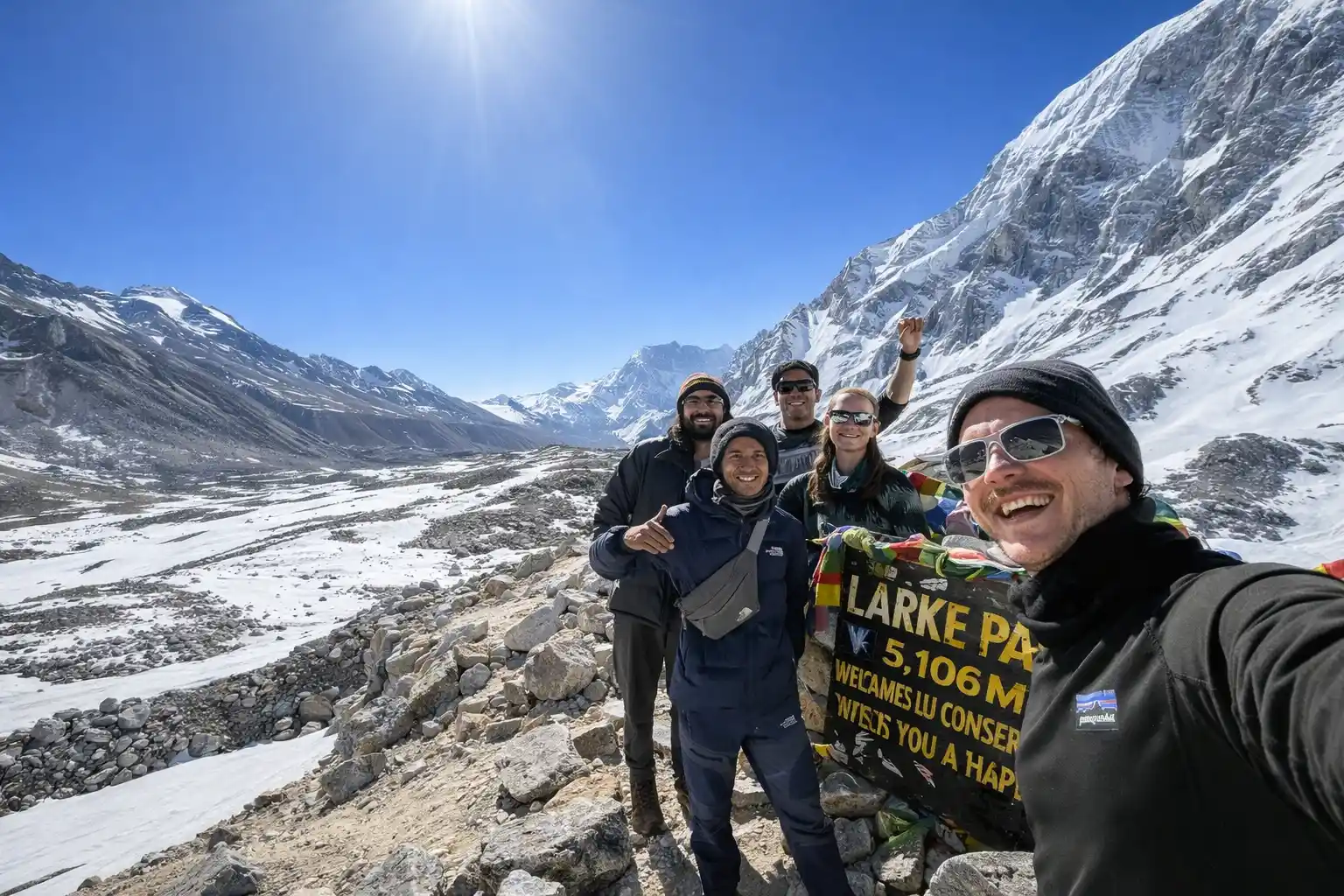
After approximately 4–5 hours of climbing, you reach the summit of Larkya La Pass at 5,160m. Standing at the top, the view is absolutely overwhelming. On a clear day you can see Manaslu (8,163m), Himlung Himal (7,126m), Cheo Himal (6,820m), Kang Guru (6,981m), and Annapurna II (7,937m) all at once. Celebrate, take photos, and breathe it all in.The long descent to the lush green valley of Bimthang takes another 4–5 hours. After the brutal beauty of the pass, Bimthang feels like absolute paradise.
- Distance: 24km
- Walk: ~10 Hours
- Max Altitude: 5,160m (Larkya La Pass)
- End Altitude: 3,720m
- Accommodation: Teahouse in Bimthang
- Meals: Breakfast, Lunch & Dinner
Day 13: Trek Bimthang to Tilije (2,300m) | 20km | 6 Hours
After yesterday’s epic crossing, today feels like a well-deserved reward. The trail descends steadily through one of the most beautiful landscapes of the entire trek, ancient rhododendron and pine forests that explode with color in the spring season.
The path crosses the Dudh Khola River and winds through wide open meadows with gorgeous views of Lamjung Himal ahead of you. You pass through the small settlement of Hampuk before arriving at the charming traditional village of Tilije. At 2,300m, the air is noticeably richer in oxygen and your body will feel the relief immediately. Relax, breathe easy, and enjoy a warm teahouse dinner after a long and satisfying day.
- Distance: 20km
- Walk: ~6 Hours
- Altitude: 2,300m
- Accommodation: Teahouse
- Meals: Breakfast, Lunch & Dinner
Day 14: Trek Tilije to Dharapani (1,860m) | 13km | 5 Hours
Your final day of trekking on the Manaslu Circuit. Savor every step. The trail descends gently through terraced farmland, apple orchards, and lush green villages. You pass through Thonje and Karte as the landscape becomes greener and more populated with every kilometer.
At Dharapani, the Manaslu Circuit trail officially meets the famous Annapurna Circuit trekking route. You will suddenly notice more teahouses, more trekkers, and better facilities, a clear sign that your remote wilderness journey is coming to a close. It is a bittersweet moment. Sit down with a cup of tea, look back at the mountains you have conquered, and feel immensely proud of what you have achieved.
- Distance: 13km
- Walk: ~5 Hours
- Altitude: 1,860m
- Accommodation: Teahouse
- Meals: Breakfast, Lunch & Dinner
Day 15: Drive Dharapani to Besisahar (760m) then to Kathmandu (1,324m) | 210km | 10 Hours
Your trekking boots can finally rest today. After a hearty breakfast in Dharapani, you board a jeep for the long drive back to Kathmandu. The route first takes you down through the beautiful Marsyangdi River Valley to Besisahar (760m), the well-known gateway town of the Annapurna Circuit.
From Besisahar, the road continues through the rolling hills and river valleys of central Nepal before finally reaching the busy streets of Kathmandu. You arrive in the evening, check in to your hotel, and step into a hot shower, possibly the best shower of your entire life. Tonight, celebrate your incredible achievement with a well-deserved farewell dinner.
- Distance: 210km
- Drive: ~10 Hours
- Altitude: 1,324m
- Accommodation: Hotel in Kathmandu
- Meals: Breakfast & Farewell Dinner
Day 16: Final Departure to Your Onward Destination
Your Manaslu Circuit Trek adventure comes to an end today, but the memories you have made will last a lifetime. After breakfast at your hotel, our Himalaya Hub team will transfer you to Tribhuvan International Airport in plenty of time for your departure flight.
As your plane lifts off and Kathmandu shrinks below you, look out the window, on a clear day, you may catch one last glorious glimpse of the Himalayan giants you have just walked around. We hope you carry home not just incredible photographs, but a deeper connection to the mountains, the culture, and the people of Nepal.
Thank you for trekking with Himalaya Hub. We hope to see you back in Nepal again very soon!
- Activity: Hotel to Airport Transfer
- Meals: Breakfast
Tsum Valley Extension
Want an even deeper Manaslu experience? Add Tsum Valley to explore quieter trails, ancient monasteries, Tibetan Buddhist villages, and remote Himalayan scenery before returning to the main Manaslu Circuit route. The combined journey usually takes 18–22 days and needs extra permits, accommodation planning, and good fitness for more consecutive trekking days. Expect costs of around $1,130–$1,590, depending on your itinerary and services. Himalaya Hub Adventure offers customizable trips and discounts across its packages, see the options below to find your ideal trek.

What Trekking Company Is Best For Manaslu Trek?
Himalaya Hub Adventure is a Nepali-owned trekking company offering customizable Manaslu Circuit Trek packages for travelers who want local knowledge, clear pricing, and reliable mountain support. All required permits are included in the package, along with three meals each day – breakfast, lunch, and dinner. The company also provides one porter for every two trekkers, with porter salary, meals, accommodation, and insurance covered.
The 13-day Manaslu Circuit Trek package costs $940 per person. The 16-day Manaslu Trek costs $1,290 per person, with group rates of $1,160 per person for 2–5 trekkers, $1,030 for 6–11 trekkers, and $970 for groups of 12–18. Private trips and fully tailored itineraries are available for trekkers who want more flexibility.
Each group is led by an experienced, government-licensed guide and carries an oximeter, first-aid kit, emergency oxygen, and an emergency communication device. Himalaya Hub Adventure helps coordinate rescue arrangements if needed, but travelers must have insurance that covers high-altitude trekking and helicopter evacuation. The company is licensed by Nepal’s Department of Tourism, holds company incorporation and PAN certificates, is a TAAN member, and reports 4.9-star ratings from 1,090+ Tripadvisor and 440+ Google reviews.
Reviews


Himalaya Hub Adventure executive director Ramesh gave us all the necessary in…
Himalaya Hub Adventure executive director Ramesh gave us all the necessary information to make our holiday really special and memorable. He attended to all our needs and gave a highly competitive quote. He provided us excellent vehicles and drivers and guide.
We set out from Kathmandu by road and visited Manakamana temple on the way to Pokhara. After a day of sightseeing in Pokhara including watching sunrise from Sarangkot viewpoint, we took next day early morning public bus to Ghandruk from where started our trek towards Tadapani . It is an ancient trade route and gives really memorable and special experiences but unfortunately we had continuous rain from the moment we started the trekking. Due to the clouds we missed the beautiful views of Himalayas which this trekking route is really famous for. We also spent some tense time in Tatopani due to the landslides along Kali Gandaki river where our guide took some excellent decisions to keep us safe.
Overall it was a great experience.
Ramit is a very good guide – very caring, knowledgeable, and always making sure I was safe and comfortable. He managed everything perfectly from hotels to food to permits. The only downside was the weather. Because of heavy rain, we couldn't see the good views from Ghorepani/Poon Hill and the trail became quite slippery and dangerous in some parts. But that's nature, nothing anyone can control, and he handled it very professionally and kept me safe. He took excellent decisions when faced with challenges posed by extreme weather conditions such as choosing a hotel accommodation at higher ground to keep us in safety in case of a flood and landslide. He sought required information for taking decisions regarding our trekking progress in difficult weather. He tested the path for safe crossing to minimise the risks that we were exposed to. He listened to our special needs and requirements and tried his best to meet with them such as ensuite accommodation, hot water, vegetarian food etc. His choice of teahouses and hotels were excellent.
Highly recommend Himalaya Hub Adventures for Nepal holiday packages.
Highly recommend Ramit Surkheti for anyone planning to trek in Nepal.
This tour is in the Himalayan hills and is relatively easy (ave. 6 hrs trekking per day). Lovely village sceneries, see Nepali agriculture, walks through the jungle and stiff climbs sometimes. 💪🏽
Communication with Puru of Himalaya Hub Adventures to book the tour and get all the details was very smooth.
Highly recommended!
From the morning pickup, bus transport, and hotel in Pokhara, through each day of trekking and our return to Kath…
From the morning pickup, bus transport, and hotel in Pokhara, through each day of trekking and our return to Kathmandu, everything was taken care of seemlessly.
Their well trained guide/porter Karan made every effort to see that we had a great experience.
This was our second time using Himalaya Hub, we had an excellent Everest Base Camp trek with them in 2018, so naturally they were our first choice when we arrived in Kathmandu this year.

Kind thanks from Julie and Ida, we will always remember🙏🏼


A huge thank you to our guides, Rosha…
A huge thank you to our guides, Roshan and Bipin, who were outstanding—professional, knowledgeable, kind, and went above and beyond to make sure everyone felt safe, comfortable, and well looked after. Roshan was especially organised at the guesthouses and meal times, quickly getting us settled in after each day’s trekking and clearly explaining the plan for the next day.
I also have a severe nut allergy, which Roshan managed with great care throughout the trek, something I really appreciated.
If you’re considering trekking in Nepal, I couldn’t recommend Himalaya Hub Adventure highly enough.






Should You Go With an Independent Guide for Your Trek?
Hiring a freelance guide might seem cheaper, but it comes with serious risks, no guaranteed teahouse beds, weak altitude safety support, and no backup if weather or emergencies strike. Nepal’s government now requires all Manaslu trekkers to go through a licensed agency with a certified guide, and you need at least two trekkers (or one trekker booked via an agency) to get your Restricted Area Permit. Himalaya Hub Adventure is a fully government-licensed company with all legal documents, TAAN and NMA certification, and guides rated 5 out of 5 on Tripadvisor and Google for safety, knowledge, and care.
No shared groups. No fixed schedules. Just a personalized journey made for you.
Required Permits for Manaslu Circuit Nepal
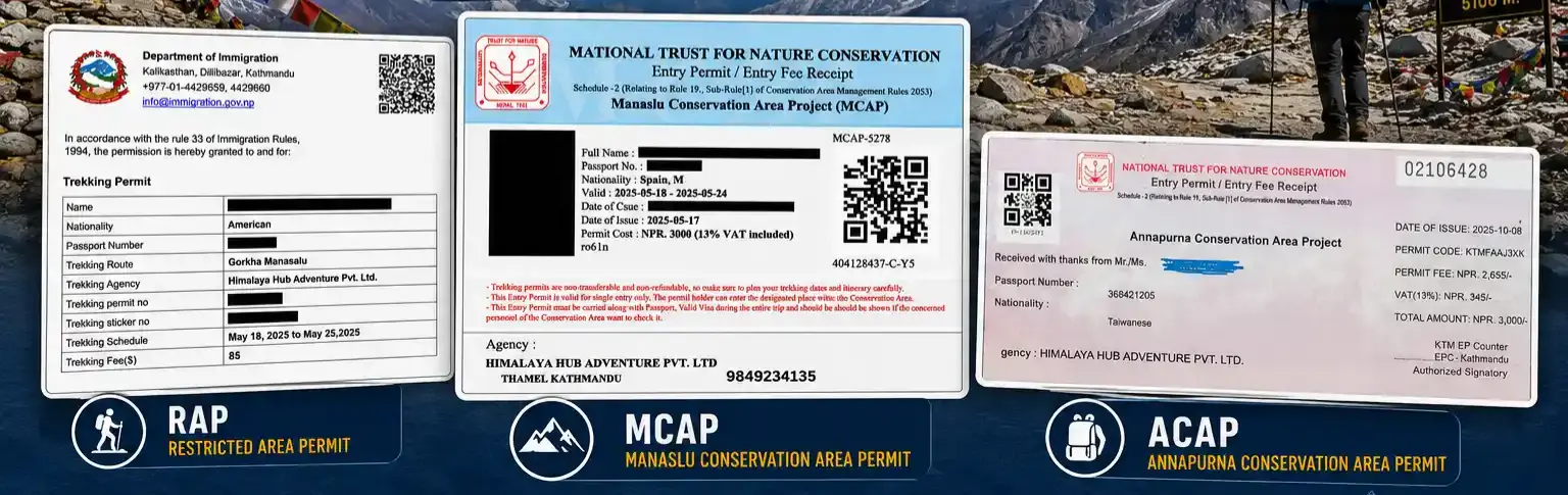
The Manaslu Trek is a restricted-area trek, so you need more paperwork than for many open trekking routes in Nepal. Your trekking agency normally arranges the permits before departure, and you should carry copies during the trek because they may be checked at Jagat, Namrung, Sama Gaun, and Dharapani. The route also enters the Annapurna Conservation Area after crossing Larkya La Pass.
| Permit | Typical 2026 cost | Why you need it |
| Manaslu Restricted Area Permit (RAP) | Sep–Nov: $100 for the first 7 days, then $15 per additional day. Dec–Aug: $75 for the first 7 days, then $10 per additional day | Required to enter the restricted Manaslu area |
| Manaslu Conservation Area Permit (MCAP) | NPR 3,000, about $23–$30 | Required for the Manaslu Conservation Area |
| Annapurna Conservation Area Permit (ACAP) | NPR 3,000, about $23–$30 | Required after Larkya La Pass when the route enters the Annapurna region |
| Chum Nubri local permit | About NPR 1,000, around $8 | Local government entry fee, generally collected in the Manaslu area |
Independent trekking is not allowed in the Manaslu restricted area. You must arrange your permit through a registered Nepali trekking agency and trek with a government-licensed guide. Minimum-two-trekker requirement, but a solo traveler can apply through an agency, but they still cannot trek independently.
Himalaya Hub Adventure includes all required Manaslu Circuit Trek permits in its package, which makes planning simpler and helps prevent checkpoint problems.
Manaslu Circuit Trek Route Map
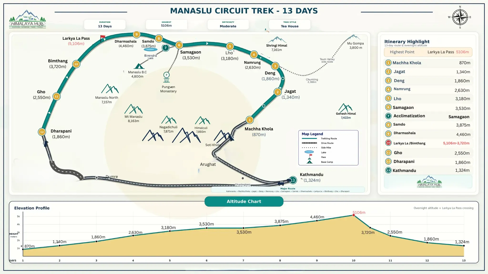
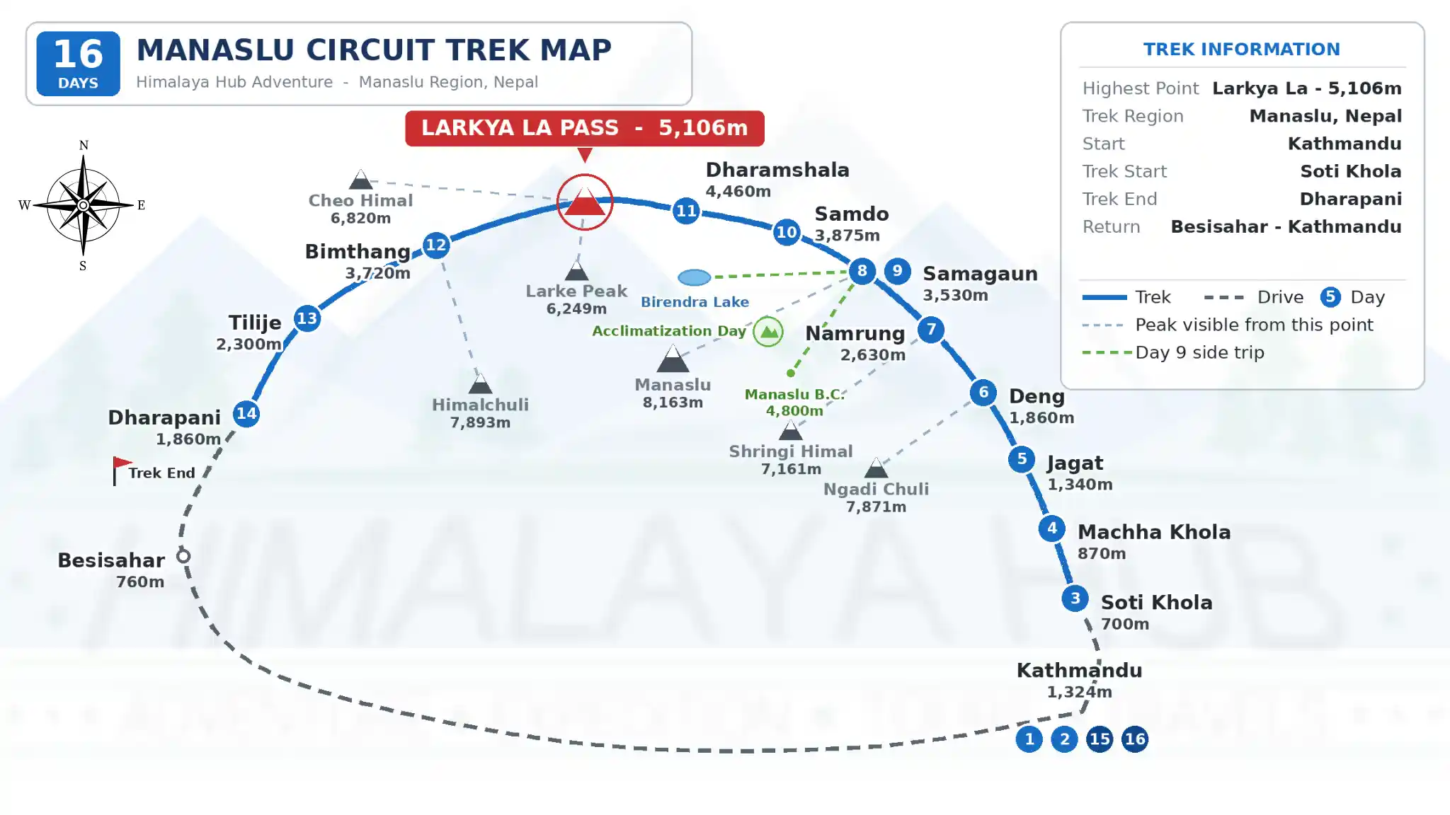
The Manaslu Circuit Trek route usually begins at Machha Khola after a drive from Kathmandu. It follows the Budhi Gandaki Valley through Jagat, Deng, Namrung, Lho, Sama Gaun, Samdo, and Dharamsala. After crossing Larkya La Pass at 5,106 m, the trail descends through Bimthang and ends at Dharapani in the Marsyangdi Valley.
How Much Does the Manaslu Circuit Trek Cost?
| Category | Budget | Mid-Range | Luxury |
| Permits | Included | Included | Included |
| Guide/Porter | Shared | Dedicated | Private |
| Accommodation | Basic teahouse | Better rooms where available | Best available rooms |
| Food | Set menus | More menu variety | Upgraded meals and drinks |
| Transport | Local jeep or bus | Private jeep | Private jeep |
| Travel insurance | Extra | Extra | Often included |
| Total cost, excluding international flights | $940–$1,290 | $1,400–$2,000 | $2,000–$3,500+ |
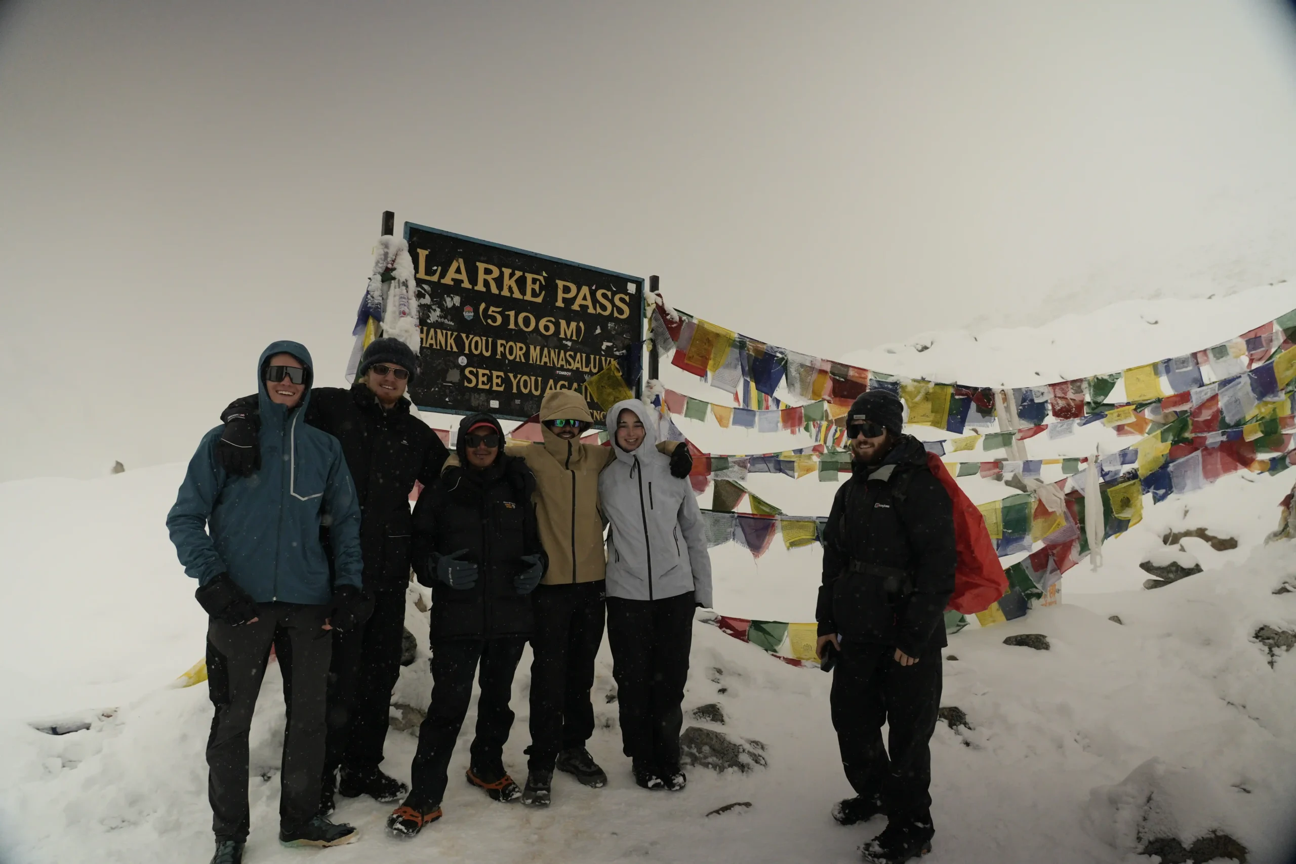
The Manaslu Circuit Trek cost depends mainly on itinerary length, group size, transport, guide and porter support, food choices, and room availability. Budget packages can start from $940, while private and luxury trips cost more. Himalaya Hub Adventure offers customizable itinerary tours and private trips, allowing you to choose a route, pace, and service level that fits your travel plans.
Chat with us — real trekking experts, not bots.
Best Season for Manaslu Circuit Trek
Spring Season (March to May) ⭐ Best
Spring is one of the best times for the Manaslu Circuit Trek. Days become warmer, mornings are often clear, and rhododendron forests bloom with bright color, especially in March and April. Lower villages may reach 15–22°C during the day, while high camps and Larkya La Pass remain very cold, often around -5°C to 5°C. Crowds are moderate, but some snow or icy sections can remain near the pass early in the season.
Autumn Season (September to November) ⭐ Best
Autumn is the most popular season for the Manaslu Trek, especially October. After the monsoon, the air is clean, trails are drier, and mountain views are usually at their best. Lower elevations often see daytime temperatures of 12–20°C, while Larkya La can range from about -6°C to 5°C. The main downside is busier teahouses, so early booking is smart. For stable weather and clear views, autumn is hard to beat.
Want to dig deeper into each month? Check out our friendly guides on trekking Manaslu in September, October, and November—we break down what to expect, what to pack, and which weeks give you the best views with fewer crowds.
Winter Season (December to February)
Winter brings serious cold, snow, and very quiet trails. At high altitude, night temperatures can fall to -20°C or lower, and heavy snowfall may close or make Larkya La Pass unsafe. The reward is amazing clear skies, fewer trekkers, and a much more peaceful Manaslu Circuit experience. However, this is best for experienced hikers with flexible schedules, proper winter equipment, and a guide who can adjust the route when weather changes.
Thinking about a winter Manaslu adventure? Our detailed guide to trekking Manaslu in December covers what to expect on the trail, how to pack for extreme cold, and tips for staying safe when the pass gets snowy.
Monsoon Season (June to August)
Monsoon makes the lower Manaslu Circuit Trek green, dramatic, and full of fast-flowing rivers. However, heavy rain can cause slippery trails, leeches, landslides, road delays, and poor mountain visibility. Some teahouses may also operate with fewer services. Upper valleys can receive less rain because of the Himalayan rain shadow, but the approach trail is still challenging. Most trekkers should avoid this season unless they accept weather delays and changing conditions.
Manaslu Circuit Trek Difficulty
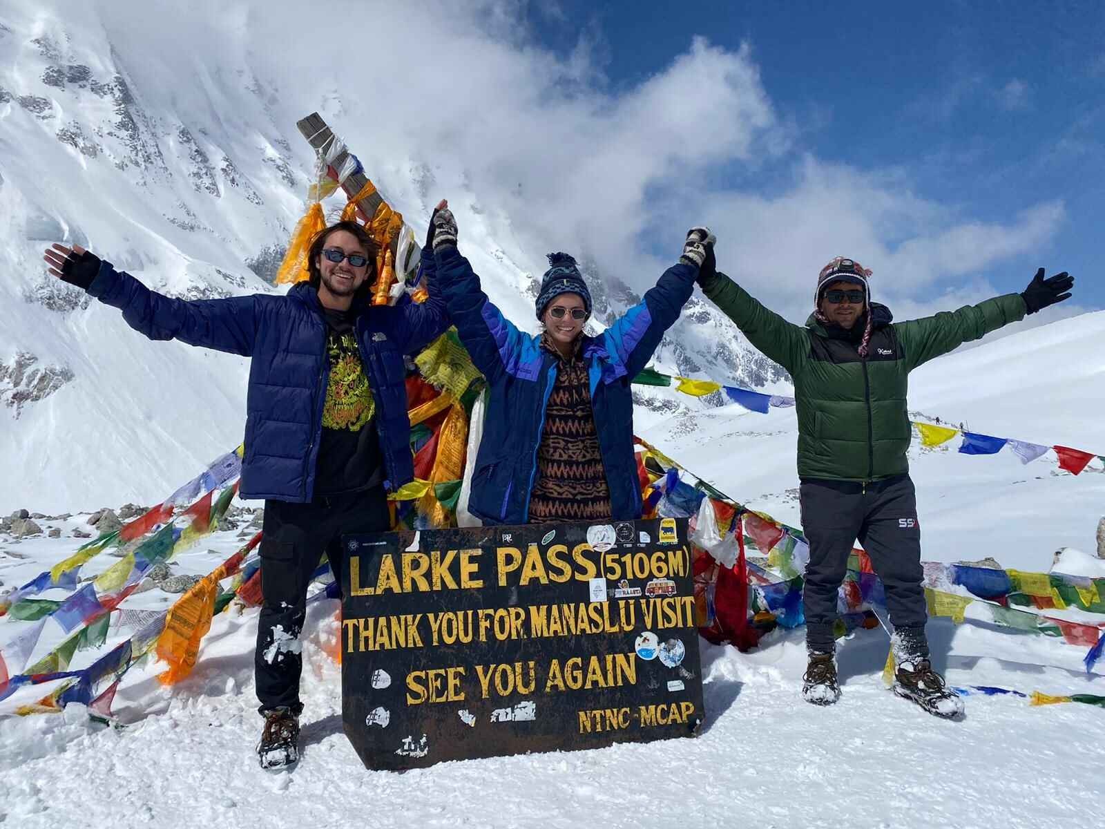
The Manaslu Circuit Trek is generally rated moderate to challenging. It is not a technical mountaineering expedition: you do not need climbing ropes, crampons, or previous climbing skills in normal trekking seasons. However, it is a long high-altitude trek that demands steady fitness, patience, and good acclimatization. Most days involve five to eight hours of walking, while the route reaches Larkya La Pass at 5,106 m. The trek becomes harder because of altitude, consecutive walking days, uneven trails, cold weather, and limited facilities in remote villages.
Why Is the Trek Difficult?
The main challenge is not one steep hill, it is doing long days repeatedly. Expect rocky paths, suspension bridges, sustained uphill climbs, and long descents that can be tough on the knees. At higher elevations, thinner air slows every step and makes recovery harder.
Weather can change quickly, especially near Larkya La Pass, where the crossing day may take eight to ten hours. Teahouses are simple in upper villages, and rough road journeys before and after the trek can feel tiring too.
Is Manaslu Circuit Trek Suitable for Beginners?
Yes, a fit beginner can complete the Manaslu Circuit Trek with proper training, a gradual itinerary, acclimatization days, and an experienced guide. Previous multi-day hiking experience is helpful because it teaches you how your body handles long walks, hills, basic lodging, and tired legs.
However, this is not a good first hike for someone with no walking background, poor altitude habits, or unmanaged medical concerns. Train for consecutive hiking days, uphill walking, and elevation gain before you go, and consult a qualified healthcare professional if you have health concerns about high-altitude travel.
Chat with us — real trekking experts, not bots.
Recommended Fitness Preparation for Manaslu
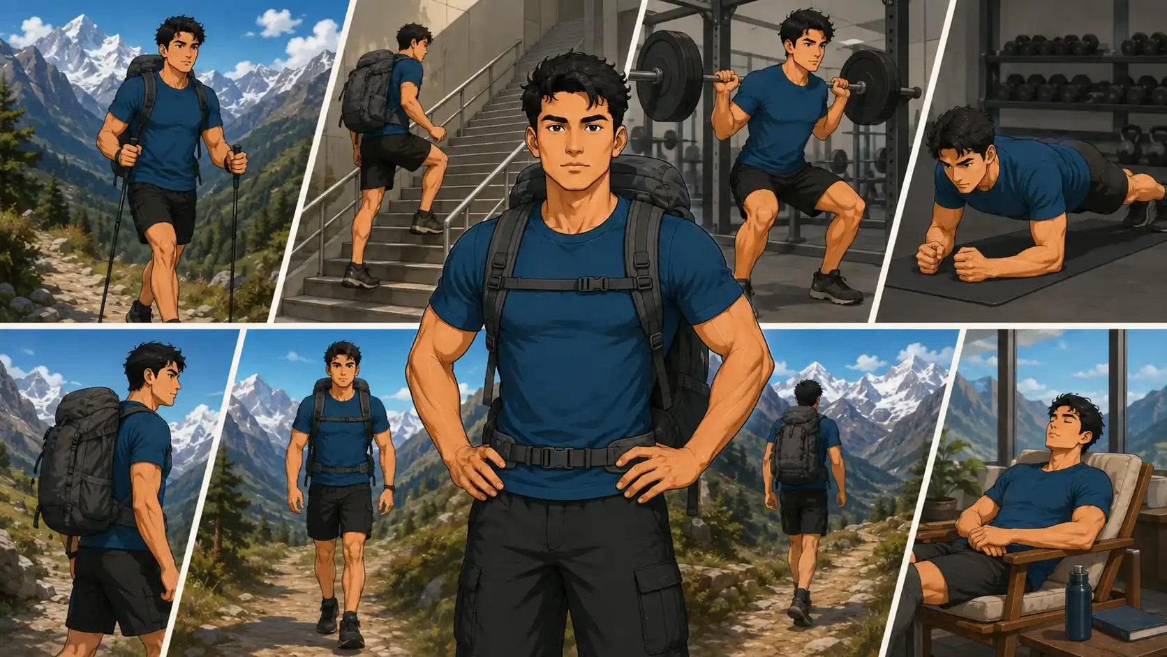
For the Manaslu Circuit Trek, give yourself eight to twelve weeks of steady training. You do not need to become an ultra-runner, but arriving with “I walk to the coffee shop sometimes” fitness is a grave mistake. The trail has long days, steep climbs, and a very cold pass day. Your legs need to be ready to work again tomorrow, not just once on a Sunday.
Start gently and increase walking time, hills, and backpack weight little by little. The goal is simple: build the stamina to walk for several hours on consecutive days without your knees, feet, or morale falling apart.
- Walk or hike 3–4 times each week, gradually building toward longer sessions.
- Add stair climbing, hill walking, or treadmill incline sessions for uphill strength.
- Train legs and core twice weekly with squats, lunges, step-ups, deadlifts, and planks.
- Practice hikes with a loaded backpack only after you are comfortable walking uphill without one.
- Schedule back-to-back walking days to copy the feeling of a real trek.
- Increase either distance, elevation, or pack weight slowly, not all three at once.
- Keep one full rest day each week; recovery is part of training, not laziness.
A good test is whether you can complete a long hike, wake up the next morning, and still walk comfortably for a few hours. If you have any medical concerns or questions about traveling at high altitude, speak with a qualified healthcare professional before your trip.
Manaslu Circuit Trek Altitude and Acclimatization
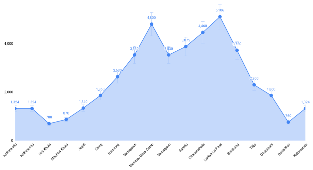
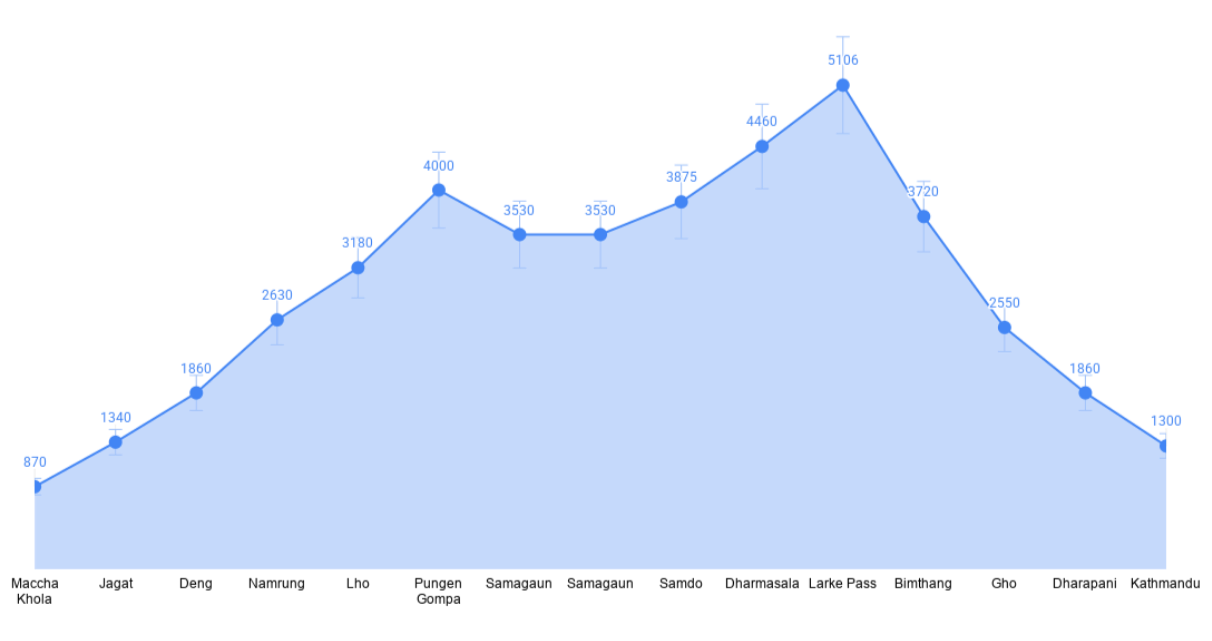
Altitude is the part of the Manaslu Circuit Trek you should respect most. The trail rises gradually from the warm, lower Budhi Gandaki Valley, but the air becomes noticeably thinner after Namrung and Lho. By the time you reach Samagaun, walking uphill can feel slow, even for fit hikers. That is normal. The key is to follow a sensible itinerary, walk at your own pace, and never treat acclimatization days as optional sightseeing days.
Samagaun, at about 3,530 m, is the main place to pause and adjust before going higher. Dharmasala, often called Larkya Phedi, is the final major overnight stop before the pass. The next morning, you cross Larkya La, usually listed at 5,106 m, although some maps show small variations. It is a high, cold, and long day, so arriving well acclimatized is 100% worth it.
Key Acclimatization Days
Use rest days to follow the simple rule: climb high, sleep low. This means you hike to a higher point during the day, then return to sleep at your lower lodge. It helps your body adjust without rushing your sleeping altitude.
- Samagaun, 3,530 m: Take a day hike to Manaslu Base Camp at around 4,800 m or Pungyen Gompa at about 4,000 m, then return to Samagaun to sleep.
- Samdo, 3,875 m: Hike toward the Tibetan border or a nearby viewpoint, then return to Samdo for the night.
- Above 3,000 m, a conservative guideline is to avoid increasing your sleeping elevation by more than roughly 500 m per night and to add a rest day every 3–4 days.
Preventing Altitude Problems
Do not try to “win” against altitude by walking faster. Stay hydrated, eat regular meals, sleep well when possible, and tell your guide early if something feels wrong. Carrying water is helpful, but do not force excessive amounts solely to prevent altitude sickness; steady drinking to stay normally hydrated is the sensible goal.
- Drink regularly; many trekkers aim for roughly 3–4 liters daily above 3,000 m, adjusted for thirst, activity, and conditions.
- Walk slowly and steadily, especially on steep climbs.
- Do not ascend to sleep higher if you have altitude symptoms.
- Watch for early symptoms: headache, nausea, loss of appetite, unusual fatigue, dizziness, or poor sleep.
- If symptoms worsen despite rest, descend with your guide.
Safety and Emergency Preparedness
A good guide will monitor how you feel, use an oximeter as one part of the assessment, and make a conservative plan when symptoms appear. An oximeter number alone does not decide whether you are safe; symptoms, trend, walking ability, and the guide’s judgment all matter. Do not hide a headache because you do not want to slow down the group. That is how a manageable problem turns into a bad one.
- Early warning signs: Headache, nausea, poor appetite, fatigue, dizziness, or trouble sleeping.
- Severe warning signs: Confusion, poor coordination, inability to walk normally, or breathlessness at rest. These require immediate descent and urgent medical assessment.
- Emergency response: Stop ascending, assess the trekker, descend with guide support, contact the trekking company and insurer, and arrange helicopter evacuation when medically necessary.
- Insurance: Bring travel insurance that explicitly covers high-altitude trekking to at least 5,106 m and helicopter evacuation.
- Guide and porter support: A licensed guide is required for the Manaslu restricted area. One porter for every two trekkers is a practical arrangement for reducing load and helping you save energy for acclimatization.
Food and Water on the Trek
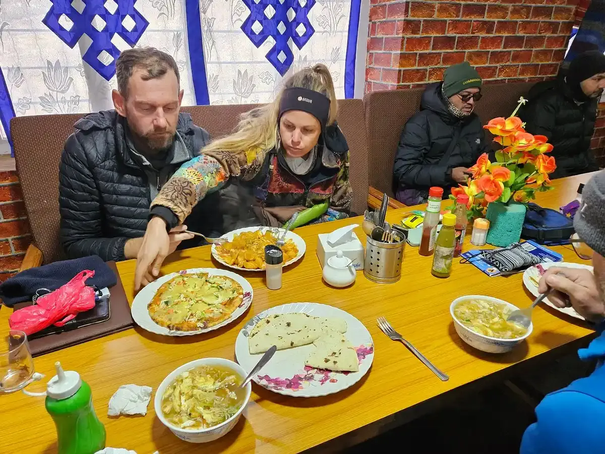
Food on the Manaslu Circuit Trek is simple, filling, and usually exactly what you want after a long day of walking. Teahouse menus become smaller as you climb higher, especially above Samagaun, so keep your expectations realistic. Hot, freshly cooked meals are the safest choice, and carrying a few favorite snacks from Kathmandu is never a bad idea.
Food Options
Dal bhat-rice, lentil soup, and vegetables, is the classic trekking meal for good reason. It is warm, filling, usually vegetarian, and many teahouses offer extra servings. You will also find noodle soup, fried rice, pasta, potatoes, Tibetan bread, tsampa porridge, and momos in larger villages. Hot lemon, tea, coffee, and hot chocolate are welcome morale boosters when the weather turns very cold.
- Choose dal bhat for a reliable, high-energy meal.
- Try Tibetan bread and tsampa more often in upper villages.
- Pack energy bars, nuts, dried fruit, and chocolate from Kathmandu.
- Expect fewer fresh ingredients and less menu variety above Samagaun.
Dietary Restrictions
Vegetarian food is widely available, and vegan meals are usually manageable if you clearly ask for no dairy, eggs, ghee, or meat. Gluten-free trekking takes more planning because bread, pasta, noodles, and many snacks contain wheat. Dal bhat can work well, but always confirm ingredients. Halal food is limited, so travelers with strict halal requirements should bring suitable snacks or discuss meal planning with their trekking company in advance.
- Vegetarian: Dal bhat, vegetable curries, potatoes, and noodle dishes are common.
- Vegan: Request plant-based meals clearly and carry backup snacks.
- Gluten-free: Focus on rice, lentils, potatoes, and confirmed gluten-free supplies.
- Halal: Bring personal snacks and confirm arrangements before departure.
Water and Hydration
Never drink tap, stream, or spring water untreated on the Manaslu Trek. Boiled water is available in many teahouses, while purification tablets, a SteriPen, or a Sawyer-style filter are useful backups. Bottled water may be sold along the trail, but it becomes expensive at higher elevations and creates unnecessary plastic waste. A reusable bottle and personal purification method are the better choice.
- Use iodine or chlorine tablets, UV treatment, a filter, or properly boiled water.
- Carry at least two reusable bottles so one can be treated while you drink from the other.
- Ask your guide about local plastic rules and dispose of waste responsibly.
- Drink regularly, but let thirst, activity level, and weather guide your intake.
Altitude and Appetite
At higher elevations, you may feel less hungry, mildly nauseous, or simply tired of menus. Still, try to eat regular meals and carbohydrates, even if you only manage a smaller plate. Skipping dinner before Larkya La is a grave mistake, you need fuel. Avoid alcohol at altitude, especially while acclimatizing, because it can worsen dehydration and altitude symptoms. Garlic soup is a popular local tradition and a warming comfort food, but it is not a cure or substitute for slow ascent and descent when symptoms worsen.
Chat with us — real trekking experts, not bots.
Manaslu Circuit Trek Packing List
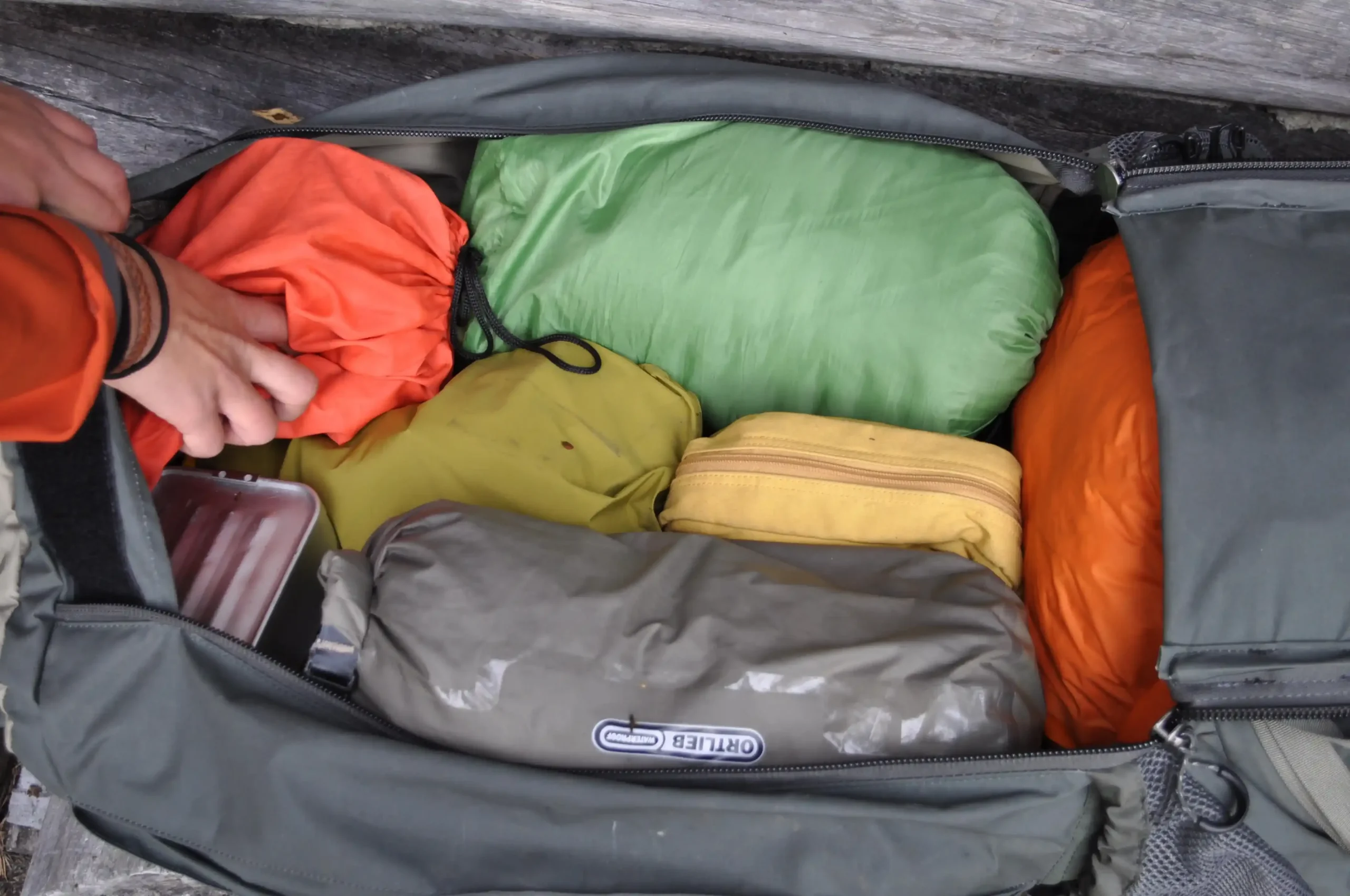
Packing for the Manaslu Circuit trek in Nepal is all about layers, not overpacking. Weather changes fast between warm river valleys and the very cold Larkya La Pass trek, so bring moisture-wicking base layers, a fleece, a warm down jacket, and a waterproof outer shell. Wear broken-in waterproof trekking boots with ankle support, new boots on this trek are a blister-making disaster. Pack warm socks, gloves, a beanie, sun hat, and UV sunglasses.
Essential equipment includes a warm sleeping bag, trekking poles, headlamp with spare batteries, reusable water bottles, a water-purification method, sunscreen, and a power bank. Keep daily essentials in your daypack and heavier gear in your porter bag.
Download our free 13-Day and 16-Day Manaslu Circuit Trek Packing List PDF for a complete, easy-to-follow checklist.
Download 13 Days Packing CheckList
Download 16 Days Packing CheckList
Culture and Traditions Along the Manaslu Circuit Trek
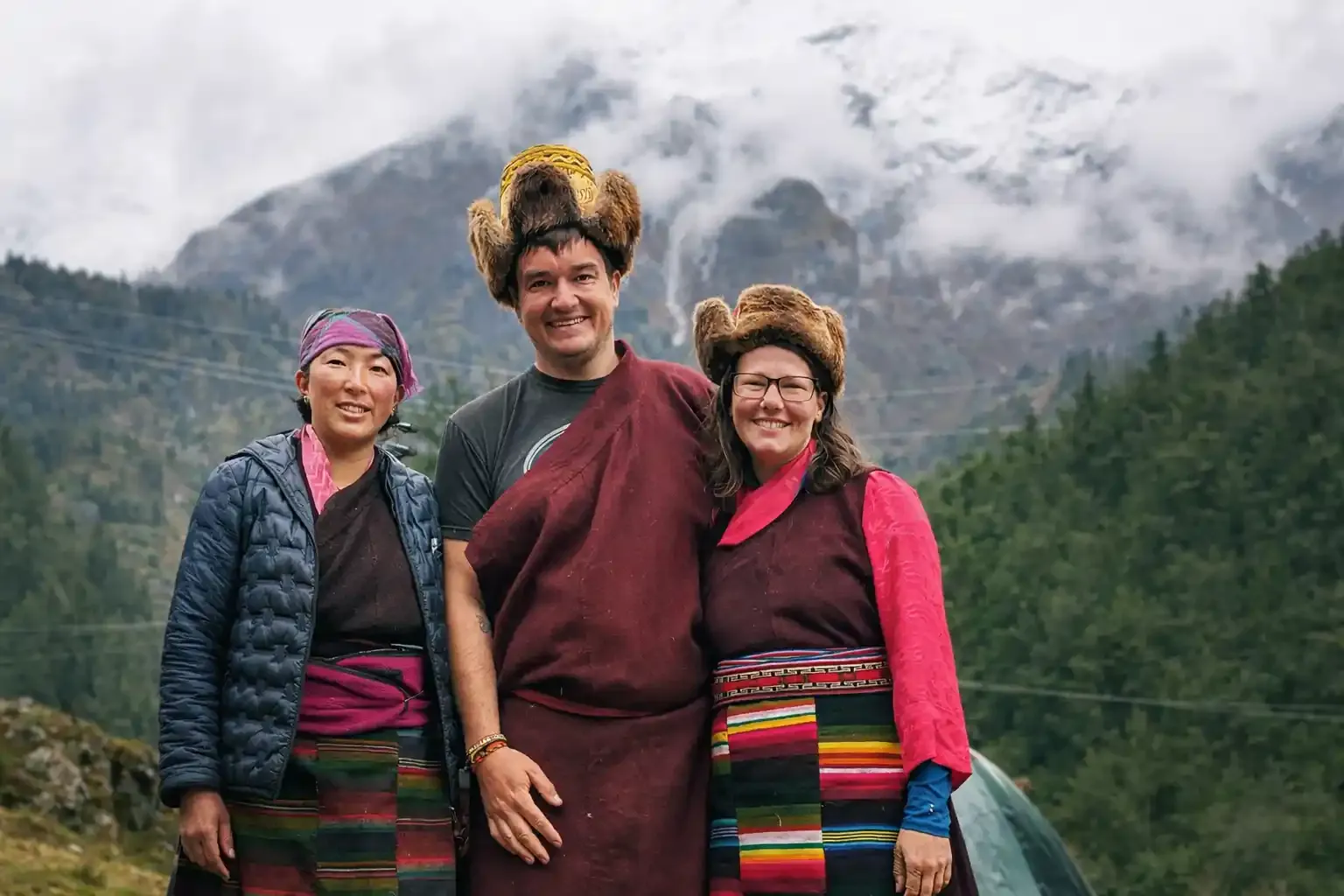
The Manaslu Circuit Trek is not only about mountains, it is also a journey through living Himalayan culture. In the lower valleys, you may notice a mix of Hindu and Buddhist communities. As the trail climbs toward Namrung, Lho, Sama Gaun, and Samdo, Tibetan Buddhist traditions become much stronger. Stone houses, prayer flags, chortens, prayer wheels, and long mani walls are part of everyday village life, not just tourist sights.
The upper Manaslu region is home to Nubri and other Tibetan-influenced communities with close historical links to Tibet. Monasteries, or gompas, remain important places for prayer, learning, festivals, and community gatherings. Ribung Gompa in Lho, Pungyen Gompa near Sama Gaun, and monasteries around Samdo are meaningful cultural stops along the trail. You may hear chanting, see monks performing rituals, or notice villagers spinning prayer wheels as they pass.
Respect is simple but important. Walk clockwise around chortens, mani walls, and monasteries, keeping them on your right. Never step over mani stones, touch religious objects without permission, or photograph people and ceremonies without asking first. Dress modestly in villages, use a quiet voice near monasteries, and support local teahouses by buying meals and services locally. These small choices help protect the traditions that make the Manaslu Trek feel so special.
Wildlife and Nature at Manaslu Conservation Area
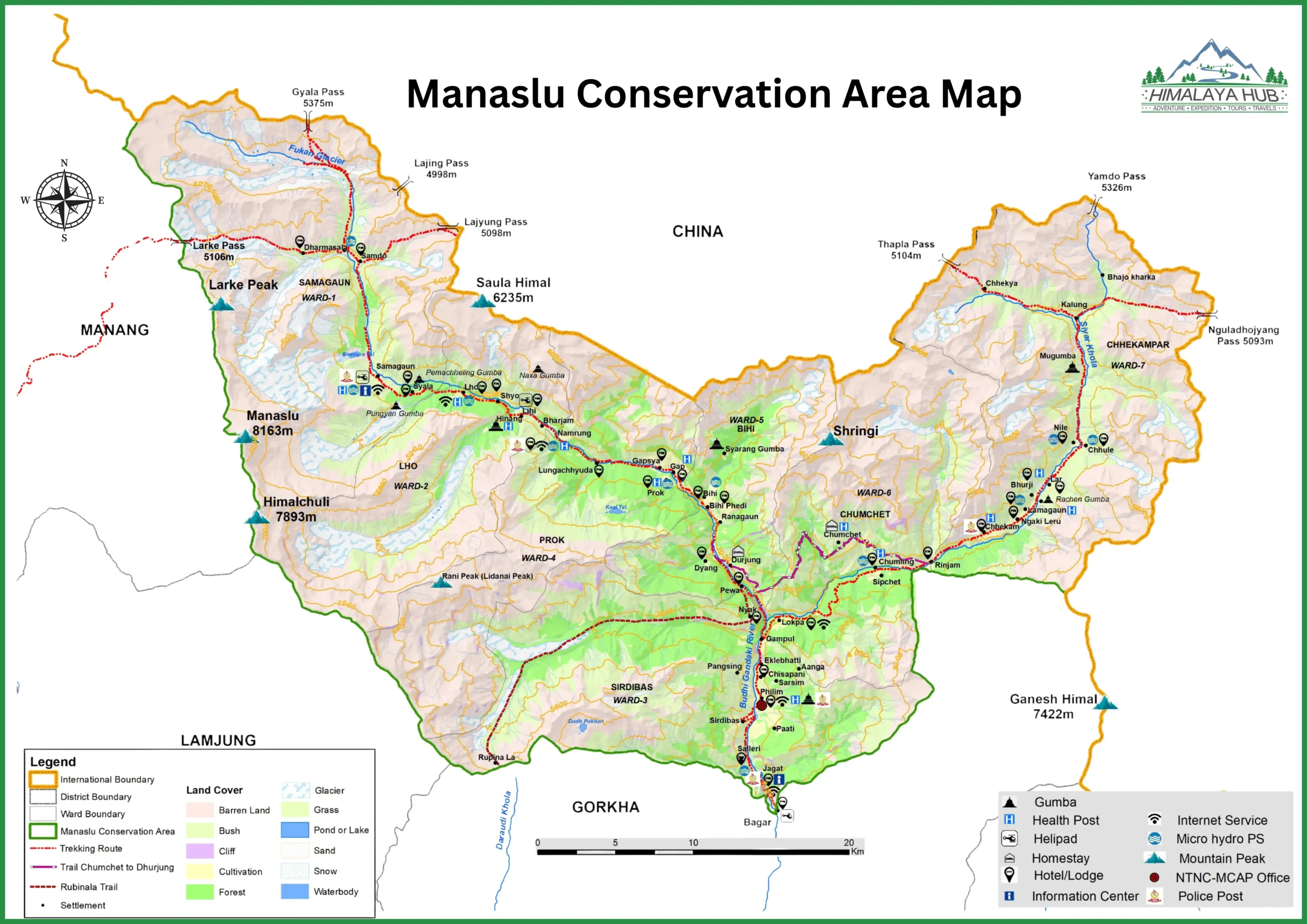
Manaslu Conservation Area is one of Nepal’s great wilderness landscapes. Established in 1998, it covers 1,663 sq km in Gorkha District and protects habitats from warm river valleys to high Himalayan slopes. The area is managed through conservation zones that include local communities, forests, alpine meadows, and mountain terrain. Its huge elevation range creates an impressive mix of wildlife and plants, making the Manaslu Circuit Trek far more than a mountain-view adventure.
The area supports many mammals, although most are shy and difficult to spot. Snow leopards, Himalayan tahr, blue sheep, musk deer, ghoral, Himalayan black bears, red pandas, langur monkeys, and Himalayan wolves live within the wider Manaslu landscape. Blue sheep and Himalayan tahr are among the animals trekkers are more likely to notice on open, high slopes. Seeing a snow leopard or red panda is rare, so consider it a bonus, not something to expect on every trek.
Birdwatchers may enjoy the Manaslu region as much as photographers. The National Trust for Nature Conservation reports 201 bird species in the conservation area, including snow partridge, Tibetan snowcock, Himalayan griffon, and golden eagle. You may also see the colorful Himalayan monal, Nepal’s national bird, along with blood pheasants, warblers, thrushes, and large soaring vultures. Early mornings and quiet forest sections offer the best chance of spotting birds.
Plant life changes dramatically as you gain elevation. Lower sections feature oak, maple, birch, bamboo, and rhododendron forests, while higher elevations have juniper, alpine shrubs, grazing meadows known as kharka, and seasonal wildflowers. The conservation area has recorded more than 2,000 plant species, including medicinal herbs used in traditional Himalayan practices. Spring is especially beautiful when rhododendrons bloom along the trail.
Responsible wildlife viewing matters. Keep a safe distance, stay quiet, and never feed or chase animals for photographs. Do not buy fur, bones, horns, or any wildlife product. Keep waste with you until it can be disposed of properly, respect local rules, and report suspected poaching or injured wildlife to your guide or conservation staff. A good wildlife photo should never disturb the animal, or damage the place you came to see.
Photography Guide for Manaslu Circuit
Best Photography Spots
The Manaslu Circuit Trek gives you dramatic mountain scenes, village life, and Buddhist culture in the same frame. Morning light is usually best, especially before the wind picks up around lakes and high passes. Keep your camera batteries warm inside your jacket near Larkya La, cold drains them fast.
- Lho Village: One of the first big Manaslu views, with a striking panorama of the mountain’s north face.
- Pungyen Gompa: A peaceful monastery framed by Manaslu, yak pastures, and high Himalayan terrain.
- Birendra Lake, Samagaun: Visit early for calm-water reflections and turquoise glacial-lake photos.
- Larkya La Pass: Wide, 360-degree Himalayan views; use prayer flags or trekkers in the foreground for scale.
- Bimthang Valley: Excellent post-pass views with glaciers, open meadows, and dramatic peaks.
- Budhi Gandaki bridges: Capture suspension bridges, steep gorges, and rushing river scenes.
- Upper villages: Photograph prayer flags, chortens, mani walls, yaks, stone houses, and everyday village life.
Drone Photography Rules at Manaslu Circuit Trek
Flying a drone on the Manaslu Circuit Trek is legally possible but tightly regulated due to the region’s restricted border status and protected conservation areas. To operate a drone here without risking confiscation at military or police checkpoints, you must complete a four-layer, multi-agency approval process well in advance.
1. CAAN Registration (Unique Identification Number)
Every drone, regardless of size, including “Nano” models under 250g like the DJI Mini series, must be registered with Nepal’s Civil Aviation Authority before any flight.
- Issuing Body: Civil Aviation Authority of Nepal (CAAN), Flight Safety Standards Department (FSSD), Sinamangal, Kathmandu.
- What You Get: A Unique Identification Number (UIN) sticker to affix on your drone.
- Cost: Approximately USD 50 plus 13% VAT for foreign nationals (some sources cite a base fee of USD 10 + VAT; confirm current rates with CAAN).
- Key Requirements for Foreigners:
- Passport with valid Nepal visa
- Customs declaration from Tribhuvan International Airport (showing the drone was legally brought in)
- Drone serial number photo and manual/spec sheet
- Completed application forms (RPA/Form/001 and RPA/Form/002 – Purpose of Operation & Commitment Letter)
- In-person submission at FSSD; online registration is generally not available for tourists drone.
2. Department of Tourism (DoT) Clearance
As a foreign trekker, you must obtain a No Objection Letter specifically authorizing aerial photography or videography.
- Issuing Body: Department of Tourism (under the Ministry of Culture, Tourism & Civil Aviation).
- Requirement: A formal application letter detailing:
- Your full trekking itinerary (Manaslu Circuit)
- Purpose of drone use (personal, commercial, documentary, etc.)
- Dates and locations of intended flights
- Note: This step often requires support from a registered Nepali trekking agency, as individual foreign applications face significant hurdles.
3. Ministry of Home Affairs (MoHA) Security Clearance
Because the Manaslu Circuit borders Tibet (China) and lies within a Restricted Area Permit (RAP) zone, airspace is treated as highly sensitive.
- Issuing Body: Ministry of Home Affairs (MoHA).
- Purpose: Provides primary security clearance to operate a camera-equipped aircraft near international borders and restricted zones.
- Process: Typically coordinated through your trekking agency or local sponsor; MoHA reviews your flight plan, purpose, and itinerary before issuing approval.
4. Conservation Area Project Approvals
The Manaslu Circuit traverses two protected conservation zones, each requiring explicit permission for drone operations.
- Manaslu Conservation Area Project (MCAP): Required for the initial sections of the trek (from Soti Khola up to Larkya La Pass).
- Annapurna Conservation Area Project (ACAP): Required once you cross Larkya La and descend into Dharapani and beyond.
- Issuing Body: National Trust for Nature Conservation (NTNC) via their e-permit system or local conservation offices.
- Important: NTNC explicitly states that drones are “strictly prohibited unless prior approval has been granted by the concerned authorities.”
Key Operational Rules to Remember
Even with all permits, you must follow strict flight rules to avoid fines or confiscation:
- Altitude Cap: Maximum 100 meters (328 feet) above ground level.
- Line of Sight: Drone must remain within 500 meters horizontally and in direct visual contact at all times.
- Prohibited Areas:
- No flying over religious monasteries, temples, or sacred sites
- No flying over local villages without explicit community permission
- No flying near military installations, police checkposts, or government buildings.
- No-Fly Zones: Maintain at least 5 km distance from any aerodrome or airport.
Practical Advice for Trekkers
- Lead Time: The full permit process typically takes 2–4 weeks for Nepali residents and 5–7 weeks for foreign nationals.
- Agency Support Strongly Recommended: Due to bureaucratic complexity and the requirement for local sponsorship, it is nearly impossible for individual tourists to secure all approvals alone. Hire a licensed Nepali trekking agency to handle the entire drone permit process on your behalf before you arrive in Kathmandu.
- Carry Documentation On Trek: Keep printed copies of all permits (CAAN UIN, DoT letter, MoHA clearance, MCAP/ACAP approvals) with you during the trek, checkpoints may ask to see them.
By following this structured, four-step approval chain and respecting operational limits, you can legally capture stunning aerial footage along one of Nepal’s most spectacular trekking routes.
Cultural Photography Ethics
The best cultural photographs come from respect, not rushing. Always ask before taking a close portrait, especially of older people, monks, children, or yak herders. A small payment or donation may be appreciated in some situations, but never assume that money gives you permission.
- Ask clearly and wait for a real yes before taking portraits.
- Do not photograph religious ceremonies, prayer rooms, or monks without permission.
- Follow all “No Photography” signs inside monasteries and sacred places.
- Avoid flash in religious spaces and never climb on stupas, mani walls, or other sacred structures for a better angle.
- Show people the photo if they are interested, thank them, and move on respectfully.
Practical Information and Logistics
Visa for Nepal
Most visitors can obtain a Nepal tourist visa on arrival at Tribhuvan International Airport, although some nationalities must arrange a visa in advance. Tourist visa fees are $30 for 15 days, $50 for 30 days, and $125 for 90 days. You can complete the online arrival form before travel through Nepal Immigration to save time at the airport. Travel with a passport valid for at least six months beyond your planned return date.
Travel Insurance Details
Travel insurance is essential for the Manaslu Circuit Trek. Your policy must clearly cover trekking above 5,000 m and helicopter evacuation from remote mountain areas. Read the exclusions carefully, especially for altitude illness, emergency rescue, and pre-existing medical conditions. Keep the insurer’s emergency number and policy details with you and your guide.
Kathmandu Pre-Trek Logistics
Stay in Thamel, Kathmandu’s main trekking neighborhood, where you will find hotels, restaurants, gear stores, money changers, and trekking agencies. You can buy or rent gear here, but check quality carefully because both genuine and replica products are sold. Allow one or two days for permits, final packing, and rest before starting. A pre-trek medical check is also available in Kathmandu if you want one.
Post-Trek Recovery in Kathmandu
Plan two or three days in Kathmandu after the trek. Road delays, weather changes, and tired legs are common, so booking an international flight for the morning after your return is risky. Use the extra time for a massage, a proper celebratory meal, or cultural visits to Pashupatinath, Swayambhunath, and Boudhanath. Your body will appreciate a hot shower and a bed that does not feel like a plywood shelf.
Banking and Money
Nepal uses the Nepali Rupee (NPR), and cash is essential on the Manaslu route. Exchange money at banks or authorized money changers in Thamel, rather than at hotels or the airport, where rates are often less favorable. Exchange rates move daily: Nepal Rastra Bank listed roughly NPR 152–153 per US dollar on August 15, 2026, so check the current rate before exchanging. Tell your bank about your travel dates and carry extra cash for snacks, charging, Wi-Fi, showers, and tips.
Health Preparations Before Departure
Speak with a qualified travel-health professional well before departure about vaccinations and personal fitness for high-altitude trekking. Hepatitis A and typhoid are key pre-travel vaccines for Nepal; hepatitis B, tetanus boosters, rabies, meningococcal vaccination, or Japanese encephalitis vaccination may be appropriate depending on your health history, trip length, and activities. Japanese encephalitis vaccination is generally not routinely recommended for short high-altitude treks, but a clinician can advise based on your full itinerary. Get dental and eye checks if needed, and bring spare prescription glasses or contact lenses.
Insider Tips and Expert Advice
Top 20 Expert Tips for Manaslu Circuit Success
The Manaslu Circuit rewards good preparation and punishes shortcuts. Treat the trek as a long mountain journey, not a race to Larkya La. These practical tips will make the route safer, easier, and much more enjoyable.
- Book permits and accommodation support 4–6 weeks ahead for spring and autumn departures.
- Do not skip acclimatization days; slow progress is smart trekking.
- Carry more cash than you expect to need for drinks, charging, showers, snacks, and tips.
- Download offline maps before leaving Kathmandu; signal is unreliable.
- Bring a 20,000 mAh power bank and a good headlamp with spare batteries.
- Start Larkya La early, following your guide’s departure time; the pass day is often 8–10 hours.
- Pack microspikes if your guide recommends them, especially in early spring or late autumn.
- Eat a proper dinner before the pass, even if your appetite is low.
- Dal bhat is usually the most reliable meal for long trekking days.
- Treat blisters immediately, tiny hot spots become very painful quickly.
- Bring boots you have already tested on long walks. New boots are a grave mistake.
- Dress in layers; Larkya La can be very cold, windy, and exposed.
- Keep your water bottle inside your sleeping bag at Dharmasala if freezing is likely.
- Save energy by using trekking poles on long descents.
- Respect the clockwise direction around stupas, chortens, and mani walls.
- Learn simple Nepali greetings; a friendly “Namaste” goes a long way.
- Send your route update by WhatsApp when signal appears, but do not depend on it.
- Garlic soup is warm and comforting, but it does not prevent altitude sickness.
- Never use a pulse-oximeter reading alone to decide whether to continue; symptoms and your guide’s assessment matter more.
- If altitude symptoms worsen, do not go higher, stop and descend when advised.
Lesser-Known Secrets of Manaslu
Birendra Lake near Samagaun is an easy side trip that many hurried trekkers miss, but its glacial setting makes it worth the time. Pungyen Gompa is another excellent detour for quiet mountain views and a deeper look at local Buddhist culture.
Wake early in Bimthang for one of the trek’s best moments: soft morning light over the valley after the pass crossing. If your route finishes through the Annapurna side, ask your guide about stopping at Tatopani’s hot springs, very welcome after days of cold trails and dusty boots. And yes, tea at Dharmasala can feel expensive, but after a freezing day in the mountains, it may be the best cup you have ever had.
Chat with us — real trekking experts, not bots.
Conclusion
The Manaslu Circuit Trek is a true bucket-list Himalayan journey for hikers who want more than a busy trail and a quick mountain photo. It combines deep river gorges, Tibetan Buddhist villages, high alpine wilderness, and the unforgettable crossing of Larkya La Pass at 5,106 m. It is challenging, yes, but it is not a technical climbing expedition. With solid fitness, warm gear, a slow itinerary, and respect for altitude, an average determined hiker can absolutely do it.
Before you go, make sure your permits are arranged through a registered trekking agency, travel with a licensed guide, and buy insurance that covers high-altitude trekking and helicopter evacuation. Spring, from March to May, and autumn, from September to November, are the best seasons for clear views and more stable conditions. Expect package costs to begin around $940 for a basic itinerary, with private and upgraded trips costing more.
The Manaslu Trek is also a privilege. You are walking through remote communities where monasteries, prayer flags, yak herding, and mountain traditions are part of everyday life. Respect local customs, reduce plastic waste, support local teahouses, and leave the trail better than you found it. The pass will be very cold, your legs will complain, and the tea at Dharmasala may cost more than you expect, but the memories will stay with you long after you return home.
Frequently Asked Questions
Can you trek the Manaslu Circuit without a guide?
Write a crisp 2026 policy section: restricted-area RAP rules, minimum 2 trekkers, agency processing, checkpoint locations, and what happens if you show up without a guide.
Is the Manaslu Circuit Trek suitable for beginners?
It’s best suited for those with prior trekking experience (e.g., Annapurna Base Camp or Langtang). Not recommended as a first Himalayan trek.
Is a guide mandatory for Manaslu Circuit?
Yes, by Nepali law (Restricted Area Permit regulations). Solo trekking is not permitted.
Can I do the Manaslu Circuit without a porter?
Yes, you can carry your own bag if physically capable. However, a guide is still mandatory.
How much cash should I carry?
ATMs end at Gorkha/Arughat. Carry NPR 40,000–60,000 ($300–450) in cash for the entire trek.
Is there electricity on the Manaslu Circuit?
Solar power available in most teahouses. Charging costs NPR 100–300 per device. No power above Samdo. Smart solution: Carry a portable power bank (Recommended 20,000 W).
How cold does it get on the Larkya La Pass?
In October (peak season), temperatures at the pass can be −10°C to −20°C before dawn. Wind chill can feel colder.
Can I book teahouses in advance?
Not always necessary, but recommended for Samagaon and Samdo during peak autumn season.
Is it possible to complete the Manaslu Circuit in less than 14 days?
Yes,you can complete the Manaslu Circuit trek in 13 days with a rest day (Samagaun). Acclimatization rest days are essential for safety. Rushing increases AMS risk significantly.
Are there ATMs along the Manaslu Circuit?
No. The last reliable ATM is in Gorkha or Arughat. Plan accordingly.
Can women trek Manaslu Circuit safely?
Yes. Many women trek Manaslu Circuit with Himalaya Hub, including solo trekkers (with mandatory guide).
What currency is used on the trek?
Nepali Rupees (NPR) exclusively. USD not commonly accepted in remote villages.
Is teahouse food safe to eat?
Generally yes if freshly cooked. Avoid raw vegetables, unpeeled fruits, and cold meats at altitude. Dal bhat is the safest and most nutritious choice.
How do I handle waste on the trail?
Pack out all non-biodegradable waste. Use toilet facilities at teahouses. For human waste in the open: bury at least 6 inches deep, 200 feet from water sources.
What’s the difference between the Manaslu Circuit and Manaslu Base Camp Trek?
Manaslu Base Camp Trek is a shorter (8–10 day) trek focused on reaching the base of Mt. Manaslu without crossing Larkya La. The Circuit is a full circumnavigation.
0 Comment